Subject: Dakota Territory
Period: 1882 (dated)
Publication: Senate Doc. #283, 48th Congress, 1st Session
Color: Printed Color
Size:
24 x 29 inches
61 x 73.7 cm
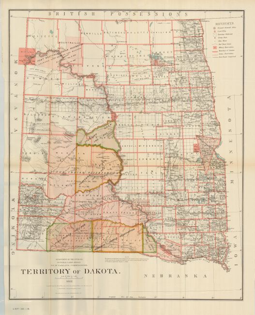
This large and striking county map shows the extent of public surveys in the territory, with Bismarck noted as the capital. Filled with details, it includes the location of military and Indian reservations, railroads, the extent of the Northern Pacific Railroad, land grants, cities, towns, county seats, and more. The Pine Ridge, Rosebud, Lower Brule, Standing Rock, Cheyenne, and Sioux Indian Reservations occupy the majority of the western portion of the territory. Economic development is still largely limited to the eastern portion. By 1880 cattlemen (many from Texas) occupied most of Dakota's range land. Drawn by C. Roeser, Principal Draughtsman. This large, detailed and beautifully lithographed map was printed by the esteemed firm of Julius Bien, N.Y.
References:
Condition: A
A near mint example less a couple small fold intersection splits. Folding, as issued.