Subject: China
Period: 1655 (circa)
Publication: Novus Atlas Sinensis
Color: Hand Color
Size:
18.8 x 15.5 inches
47.8 x 39.4 cm
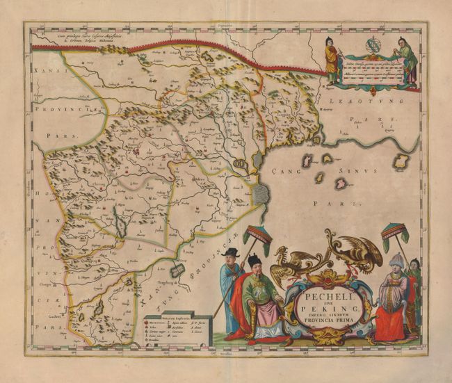
This superb map of the province of Peking is the most ornate of the fifteen provincial maps in this landmark atlas of China. These maps were compiled by Father Martino Martini, an Italian Jesuit, based on Chinese sources between 1643 and 1650. The atlas greatly advanced European knowledge of the region including the astronomical positions of many cities and topographical features. It remained the standard geographical work on that country until the publication in 1737 of D'Anville's Atlas de la Chine. This map includes a graphic depiction of the Great Wall stretching across the top of the map and the important salt fields are graphically depicted along the coast. Peking is named Xuntien. The title cartouche is flanked by a fabulously attired Emperor and Empress with their attendants, and a pair of phoenix perching between them. The scale of miles cartouche includes Chinese surveyors.
References:
Condition: B+
Lovely original color on a sound sheet with some irregular toning.