Subject: Middle East
Period: 1730 (circa)
Publication:
Color: Black & White
A nice pair of maps focusing on ancient Babylon and Mesopotamia.
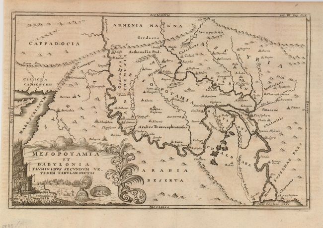
1) Mesopotamia et Babylonia Fluminibus Secundum Veterem Tabulam Ductis is a lovely map of the ancient regions of Babylon and Mesopotamia, now Iraq, Syria, Jordan and portions of Iran. The map is decorated with a representation of the construction of the Tower of Babylon. Published by Christopher Cellarius in Geographia Antiqua, circa 1732. A dark impression on a sheet with a little irregular toning. Condition B+ (12 x 8").
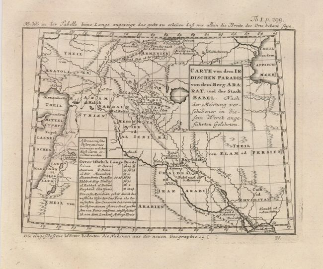
2) Carte von dem Irdischen Paradis, von dem Berg Arrat, und der Stadt Babel covers the region from the Mediterranean through Persia. It shows two locations of Paradise, one in Armenia and one on the Euphrates River near the Persian Gulf. There is a tiny Ark shown perched atop Mt. Ararat. Anonymous, circa 1730. The map is in excellent condition - A+ (7.6 x 5.7").
References:
Condition:
See descriptions.