Catalog Archive
Auction 124, Lot 443

"Ducatus Brabantiae Tabula Continens Sacri Imperii Marchionatum et Dominium Mechliniense…", Danckerts, Justus

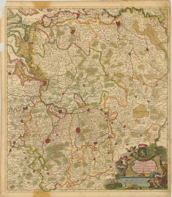
Subject: Low Countries

Period: 1700 (circa)

Publication:

Color: Hand Color

Size:
19.5 x 22.3 inches
49.5 x 56.6 cm
Download High Resolution Image
(or just click on image to launch the Zoom viewer)

A sharply engraved map of the whole region of Brabant reaching as far as Breda and Berg op Zoom in the north and Maastricht and Brussels in the south. The decorative cartouche incorporates the scale of miles and it is surrounded with putti and other figures with the coat of arms at top.

References:

Condition: C+

Nice original color and impression. The map has a few worm tracks with some loss in the right border, with an old paper repair. There are some marginal stains that encroach slightly into the map and there is some paper loss coming within 1/8" of the border on the left. There are some tears into the map on the left as well. Still an attractive map that would frame well.

Estimate: $200 - $275

Sold for: $100

Closed on 5/7/2008

Archived