Subject: Britain
Period: 1904-50
Publication:
Color: Printed Color
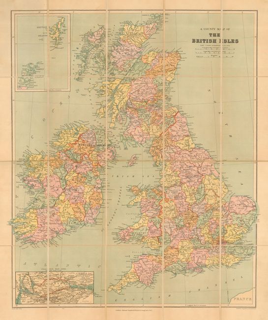
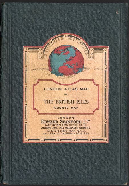
A County Map of The British Isles (19 x 23"), Edward Stanford, London, circa 1904. This popular English map, which is dissected and backed with linen, shows numerous rivers, canals and place names. Also featured is an inset of the Shetland and Orkney Islands and another inset depicting a proposed route for two shipping canals through Scotland. One canal starts in Alloa and ends at Loch Lomond, the other travels from Grangemouth, on the Firth of Forth, westward, past Glasgow and ends at the mouth of the River Clyde. The map folds into hard, cloth covered boards that measure 5" x 7", and has two labels advertising other Stanford publications. Map good but with thumbtack holes at each corner, not affecting the image, some minor soiling and a pen mark near the center of York County. Covers slightly worn with some splitting along corners of the spine. Still a very nice example.
Chichester's Picture Map of London (21.5 x 21.3"), circa 1950. 8vo. Pictures of 230 buildings and monuments of interest or importance on a map printed in 6 Colours covering 22 square miles of London Streets. Short descriptions of the 50 main places of interest to a visitor, plus a list of theaters and cinemas. A cross-referenced index of 4,200 streets. On verso is a map showing the locations of shops, hotels, restaurants, Metro Underground stations and embassies. The map is printed on heavy stock, and folds into the original red cloth covered boards measuring 4.8 x 7.5". With gilt title on front. Map has some faint toning, and the spine is partially separated.
References:
Condition: A
See descriptions.