Subject: Martinique
Period: 1704-1823 (dated)
Publication:
Color:
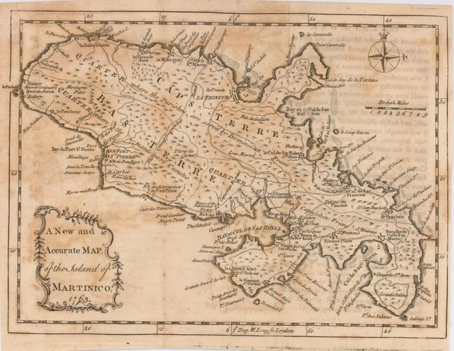
1) A New and Accurate Map, of the Island of Martinico, John Entick, London, uncolored, 1763 (9.3 x 7.0"). Small, but nicely detailed map showing the island divided into three divisions of religious influence; the Capuchin Friers, the Jesuits and the Dominican Friers. This uncommon map shows several well-defined roads, including one labeled as the "most frequented." Additional details include forts, towns, hospitals and topography. A decorative title cartouche and simple compass rose are also featured. Map is overall foxed or offset. Grade C+.
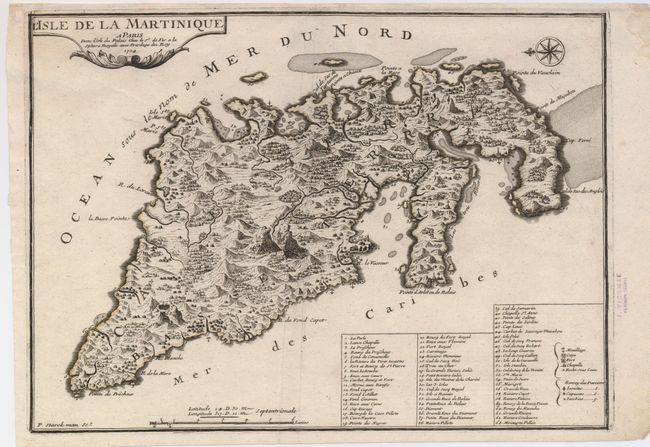
2) L'Isle de la Martinique, Nicolas de Fer, Paris, 1704, uncolored (14 x 10"). Very attractive map with excellent detail of towns, villages, churches, and forts. It also identifies different religious sects. The topography is shown in a more animated style than is normally seen on maps of this era. The map features a key to 63 locations, a decorative title cartouche, and a nice compass rose that orients north to the left. Engraved by P. Starckman. Map has a small damp stain in the margin at upper right, away from image, and there is a personal library stamp in the right margin. A dark, early impression. Grade A.
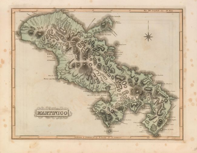
3) Martinico, Fielding Lucas, circa 1823, hand colored (12.4 x 9.5"). The fine engraving gives a 3-D effect to this nicely colored chart of the island. It provides good coastal and interior detail with numerous place names, rivers, roads, mountains, forts and more. A small compass rose and title cartouche decorate the sheet. From the General Atlas, Baltimore. Map has a little foxing or offsetting, more foxing in margins. Grade B+.
4) Isle de la Martinique, George Louis le Rouge, circa 1748, Paris, hand colored (11 x 8"). An attractive map from Le Rouge's Atlas Nouveau Portatif. A long trail runs nearly the entire length of the island from La Basse Pointe to Sac Marin. The map shows the locations of forts, settlements, and plantations with details of the coastline, anchorages and navigational hazards. With delicate, original outline hand coloring. Very lightly toned along centerfold and two hinge tape remnants in upper margin. Grade B+.
References:
Condition:
See descriptions