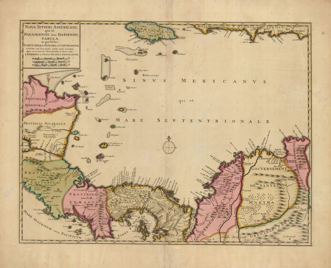
Subject: Panama
Period: 1730 (circa)
Publication: Atlas Minor Sive Geographia Compendios…
Color: Hand Color
Size:
21 x 16 inches
53.3 x 40.6 cm
This is an early edition of this important map of Panama extending from Honduras to Colombia and as far as Jamaica. The map details the major ports along the route of the Spanish treasure ships to and from Cartagena and Portobello, both shown as fortified cities. The history of this map is complicated; it was issued separately and as part of a large six-part map illustrating the War of Jenkin's Ear in 1740-41. This is the separately issued state as it contains its own title cartouche. Further, this map is without the course of the treasure fleet, indicating an earlier edition. The earliest known advertisements to sell this map date from May, 1740. However the partnership of Josua and Reiner began in 1725; thus we have dated it circa 1730.
References: Kapp (MCC-73) #36.
Condition: B
Lovely original color with some faint foxing and a repaired tear on bottom centerfold, entering map about one inch.