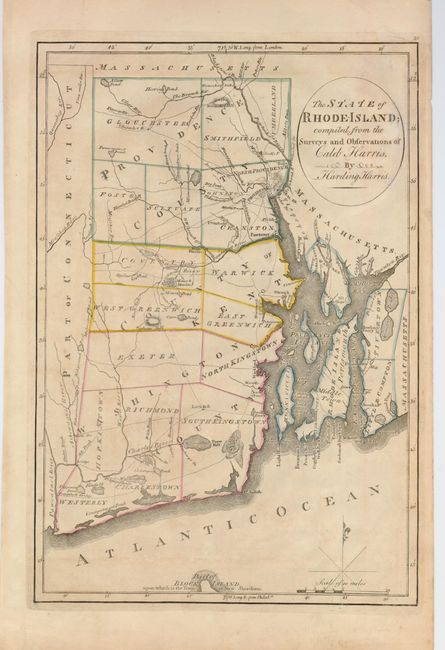
Subject: Rhode Island
Period: 1814 (published)
Publication: Carey's General Atlas
Color: Hand Color
Size:
9.4 x 13.6 inches
23.9 x 34.5 cm
Mathew Carey was a seminal figure in early American publishing; establishing the first publishing firm to specialize in cartography and issuing the first atlas devoted exclusively to American maps. He set up an elaborate cottage system of craftsmen for compiling, engraving, printing, and coloring maps. This practice was emulated by later American cartographic publishers such as John Melish and Henry S. Tanner. The American Atlas concept was also adopted by other publishers in both the United States and Europe.
A fascinating and early look at the state that details roads, bridges, ferries, villages and cities, rivers, ponds, township and county boundaries. The northern tip of Block Island is named. Features include a small block plan of Providence, all of Narragansett Bay with Conanicut Island, and a smaller block plan of Newport. It locates Warren, Pawtuxet, North Kingstown, Mt. Hope and Mt. Hope Bay, Prudence Island and Pt. Judith at the entrance to the Bay. A simple compass rose and fleur-de-lys with mileage scale grace the map. This boldly engraved chart was drawn by Harding Harris.
References: cf Wheat & Brun #250.
Condition: B+
Delicate old color with faint irregular toning and a light damp stain.