Subject: Portland, Maine
Period: 1827-1887 (dated)
Publication:
Color: Black & White
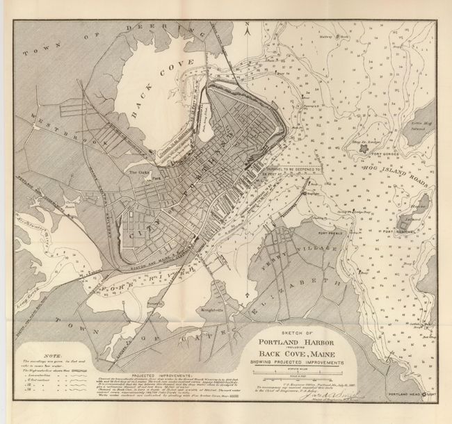
1) Sketch of Portland Harbor including Back Cove, Maine, 1887, U.S. Army, Washington D.C. (11 x 10"). There is great detail of the city with streets, bridges, railroads, the dry dock, soundings, and more. Hog Islands Roads, Fort Preble, Fort Gorges, Fort Scammel, lighthouses, etc. are located. Recommended improvements are shown in the harbor and expanded upon in notes at bottom. Folding. Grade A+.
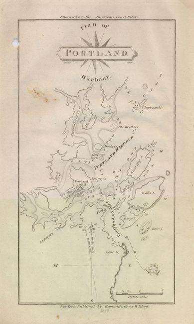
2) Plan of Portland Harbour from the "American Coast Pilot," by Edmund & George Blunt, 1827, New York (4 x 7"). The chart extends north to include Clapboard Island and shows a three-masted clipper ship preparing to enter Portland Sound. A tiny depiction of the Observatory is indicated on Munjoy Hill, where it still stands. There is a small (1/4") hole in the left margin just touching the neatline. Grade B.
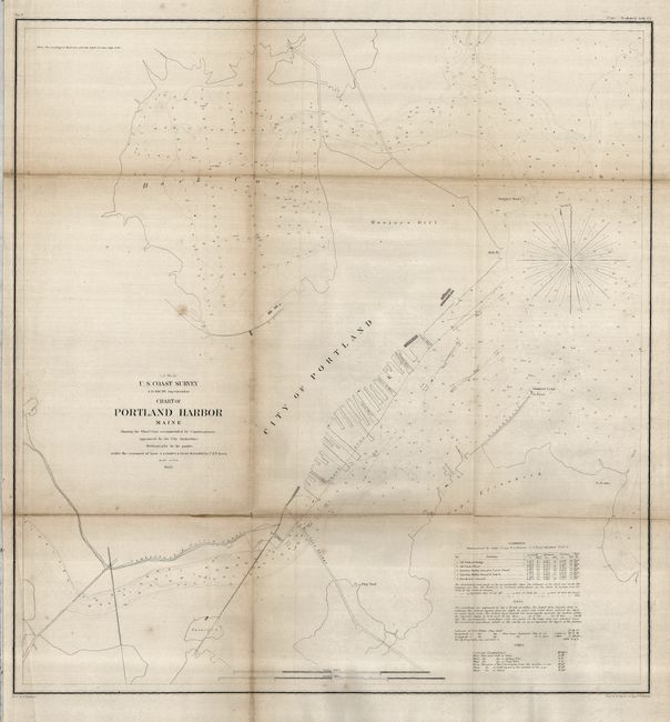
3) Chart of Portland Harbor Maine Showing the Wharf Line…, U.S. Coast Survey, 1855 (20.3 x 21.6") This chart shows good detail of the wharf area and locates Turner's Island, the dry dock, Fort Preble, the lighthouse at Stanford Ledge, the Back Cove, etc. Notes at lower right give information on tides and currents, and other general sailing information. Toned along folds with some weakness evident. Folding. Grade B.
References:
Condition:
See individual descriptions.