Subject: World
Period: 1705 (circa)
Publication: Navigantium atque Itinerantium Bibliotheca
Color: Hand Color
Size:
21 x 11.5 inches
53.3 x 29.2 cm
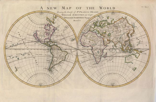
This is a scarce map of the world showing California as an island. The partial coasts of New Guinea and Australia are shown as one coastline, and a small amount of New Zealand is indicated. The tracks of the circumnavigators Drake in the 16th century, Schouten in the beginning of the 17th century, and the voyage of Dampier in 1701 are noted. Dampier circumnavigated the world three times; the last time as captain of the HMS Roebuck. The Roebuck foundered near Ascension Island and its crew was rescued by another trader's ship. Once returned to England, Dampier was court-martialled for cruelty because a crew member who was removed from the ship on the outward voyage and jailed in Brazil complained to the Admiralty. Dampier's wages were docked and he was thrown out of the Navy as a result.
References:
Condition: A
A good impression on a sturdy sheet with a couple of light creases, some reinforced on the verso with tissue.