Subject: Eastern United States
Period: 1880 (dated)
Publication:
Color: Black & White
Size:
18.5 x 12 inches
47 x 30.5 cm
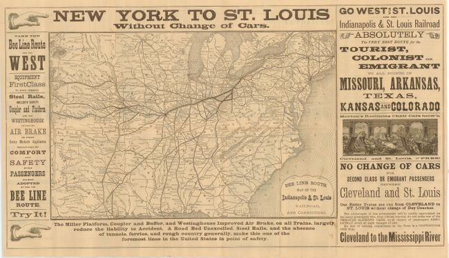
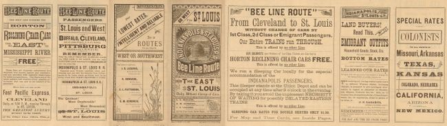
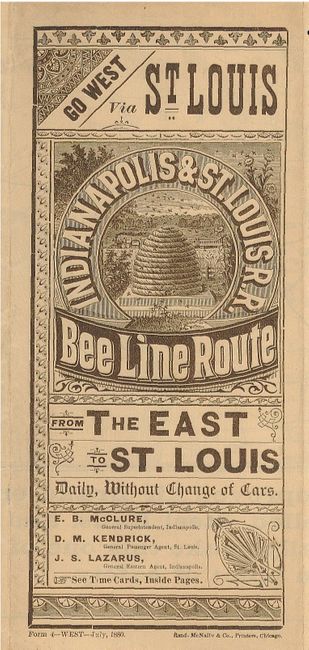
This railroad timetable features a map of the United States east of the Rocky Mountains that shows several railroad routes, Indian reservations, and forts. The map is surrounded by advertising claims for the railroad, including a nice graphic for Horton's reclining chair. All stops between Cleveland and St. Louis are named. Folds into self covers (3.6 x 8.5") with extensive timetables on verso; cover title, "Go West St. Louis via Indianapolis & St. Louis R.R. Bee Line Route."
Of particular interest is Gen. MacKenzie's Trail and Gen. McKenzie's Battlefield in the Texas panhandle. These features refer to the Army's successful campaign against the Commanche Indians in their stronghold in the Staked Plains during the Texas Indian Wars.
References:
Condition: B+
A few intersectional fold splits repaired with archival tape on the map side, and a small bit of loss in blank area at bottom. There are a few unobtrusive spots.