Subject: Eastern United States
Period: 1800-1835 (circa)
Publication:
Color: Hand Color
A nice pair of maps of the eastern United States from the early part of the 19th century showing transitional borders on the western frontier.
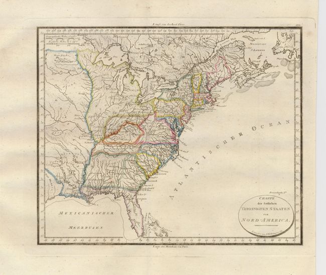
1) Charte der ostlichen Vereinigten Staaten von Nord-America is an attractive, copper engraved map by J. N. Champion, circa 1800. It depicts the United States east of the Mississippi River and extends a bit west to the eastern boundary of Neu Mexico, including a portion of the Louisiana Territory. Ohio is oddly shaped and the region northwest of that is labeled Indiana. There is a tentative division of the large state of Georgia, separating it from what would become Mississippi and Alabama. Franklinsville appears as a village in eastern Kentucky. (9.8 x 8").
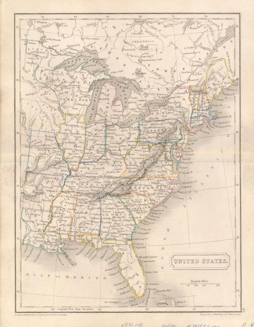
2) Sidney Hall's map of the United States was published in London about 1835. This detailed, small map covers the eastern part of the United States, plus southern Canada from the Atlantic to Lake Winnipeg and shows the early Wisconsin Territory incorporating the Upper Peninsula of Michigan and a portion of Minnesota. The only states west of the Mississippi are Missouri, Arkansas and Louisiana. (7.4 x 9.6")
References:
Condition: A
1) Very good condition on a sturdy sheet with a couple minor marginal spots. 2) There is a short centerfold split, repaired on the verso with archival tape. A little adhesive residue on verso, faintly showing in the margins.