Catalog Archive
Auction 124, Lot 134

"New Commercial Map of the United States and Adjacent Territory", Barrecchia, Bartholomeo

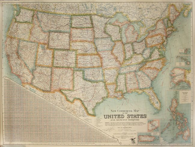
Subject: United States

Period: 1925 (dated)

Publication:

Color: Printed Color

Size:
51 x 38 inches
129.5 x 96.5 cm
Download High Resolution Image
(or just click on image to launch the Zoom viewer)

An informative and large map of the United States that is absolutely filled with detail. It is inset with maps of Samoa, Hawaii, Alaska (showing the Nome and Klondike Gold Regions), the Philippines, the Panama Canal, and Puerto Rico. The map includes the routes of the 'submarine telegraph cables,' transcontinental and interstate highways, as well as the height of mountains. This chromolithographed map was published by the Societe Editrice Geographique and sold for the sum of $12.

References:

Condition: B+

A bright example with some crumpling at the top margin, not affecting the map. There are a couple faint spots of foxing.

Estimate: $300 - $450

Sold for: $325

Closed on 5/7/2008

Archived