Subject: Canada
Period: 1855-1875 (published)
Publication:
Color: Hand Color
This is a nice group of nineteenth century maps of Canada.
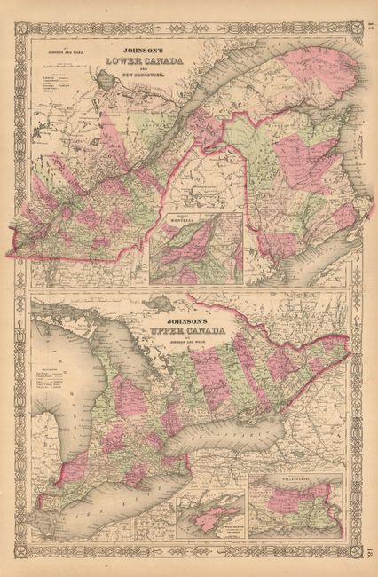
1) Johnson's Lower Canada and New Brunswick. / Johnson's Upper Canada, Johnson and Ward, c. 1863 (15.8 x 24").
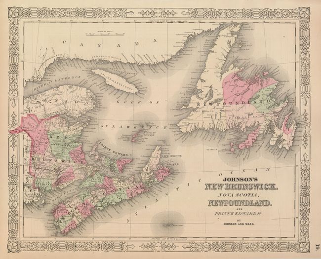
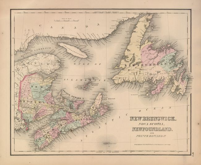
2) Johnson's New Brunswick, Nova Scotia, Newfoundland, and Prince Edward Id., Johnson and Ward, c. 1863 (15 7 x 12.7").
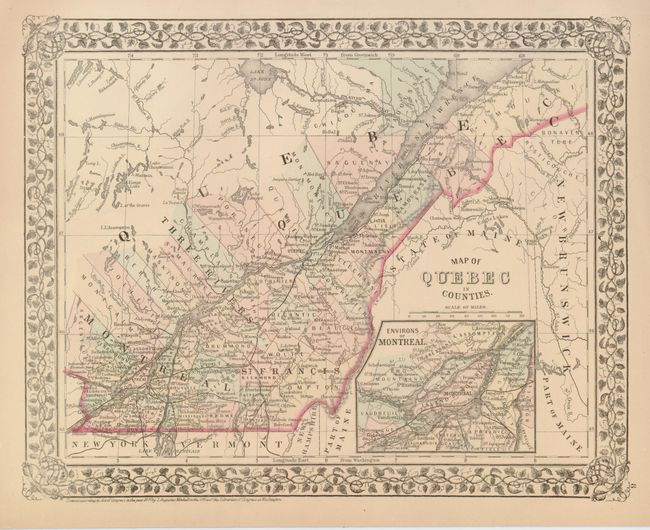
3) Map of Quebec in Counties, Samuel A. Mitchell, 1874 (13.5 x 10.7").
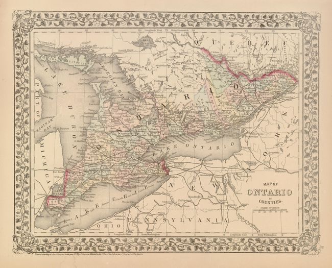
4) Map of Ontario in Counties, S. A. Mitchell, 1874 (13.5 x 10.7").
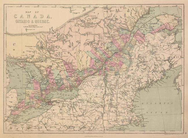
5) Map of Canada, Ontario & Quebec, J. David Williams, c. 1875 (17 x 12.3").
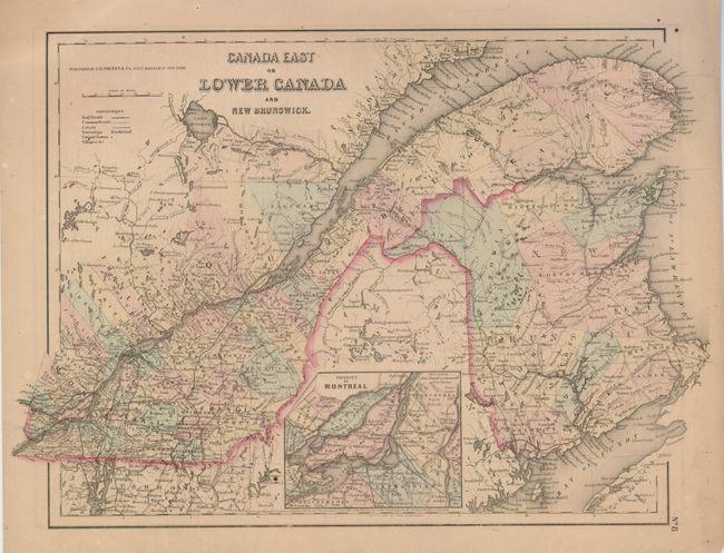
6) Canada East or Lower Canada and New Brunswick, J.H. Colton, 1855 (16.5 x 11.8"). This is from the General Atlas with a plain border.
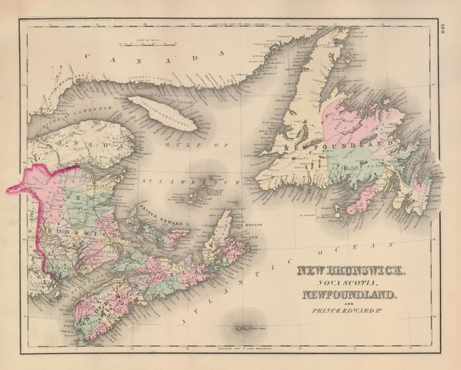
7) New Brunswick, Nova Scotia, Newfoundland and Prince Edwards Id., J.H. Colton, 1855, from the General Atlas (14.5 x 11.8").
8) New Brunswick, Nova Scotia, Newfoundland and Prince Edwards Id., J.H. Colton, 1855, from the General Atlas (14.8 x 11.8").
References:
Condition: A
All very good with a few minor defects in blank margins.