Subject: Guide Books
Period: 1859 (published)
Publication:
Color: Black & White
Size:
4.5 x 6 inches
11.4 x 15.2 cm
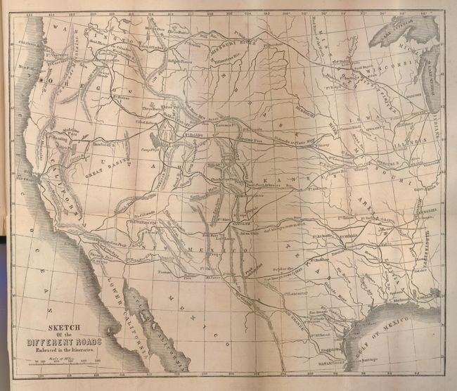
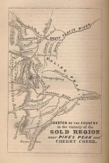
Charming first edition traveler's guide with numerous engraved illustrations and a pair of uncolored maps. Bound into the back of the book is a foldout map of the western U.S. titled; Sketch of the Different Roads Embraced in the Itineraries (11 x 9"). This map shows watershed, topography, forts and towns in addition to Marcy's route of 1849. The second map, Sketch of the Country in the Vicinity of the Gold Region Near Pikes Peak and Cherry Creek is a single-page close up map of central Colorado showing topography, watershed and early wagon roads. (3 x 4.5")
Marcy was charged with the task of creating a reliable guide for those who wished to travel to the western United States by the Federal Government, due to his25 years of living in the wilderness, and the experiences he endured on the long marches while serving in the U.S. military. In the guide, he offers advice on matters of navigation, sanitation, and many other obstacles one would expect to encounter on a long journey across the open spaces of the West.
Rebound in blue cloth with printed title on spine. Complete with 340 pages. 18mo.
References:
Condition: B+
Folding map has a short binding tear and some light occasional foxing. Covers, spine and binding clean and sound. Withdrawn form Rosenberg Library, with a perforated library stamp on title page and a catalog number on spine.