Subject: New York, New Jersey
Period: 1884 (dated)
Publication:
Color:
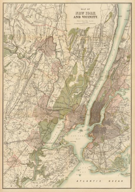
A very uncommon pair of handsome and well-colored maps by this little known publisher. The first is a well detailed and handsome map centered on New York City. It extends to show the region from Dobb's Ferry south to include Woodbridge, NJ. With remarkable detail at a scale of 1.3 miles per inch it shows towns and villages, streets, buildings, railroad lines, wagon roads, commercial piers, ferries, islands, and much more. (19 x 27.5")
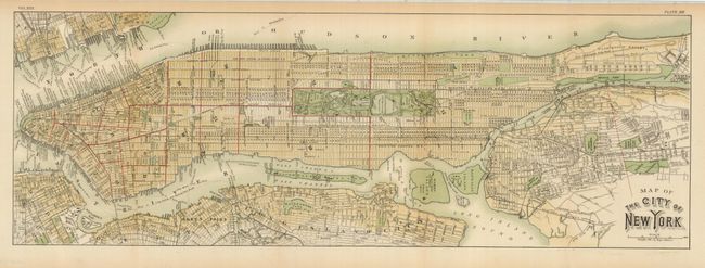
The second map a detailed plan of Manhattan that extends north to above Claremont Park. The Brooklyn Bridge is labeled "Suspension Bridge." Every street is named as are the parks and many buildings. Locates ferries, commercial piers railroads, and much more. (26.5 x 9.1")
References:
Condition: A
Both with fine bright coloring and full margins. Issued folding, both are pressed and backed with archival tissue.