Catalog Archive
Auction 123, Lot 268

"Map Showing the Boulevards and Park System and Twelve Miles of Lake Frontage of the City of Chicago", Rand McNally & Co.

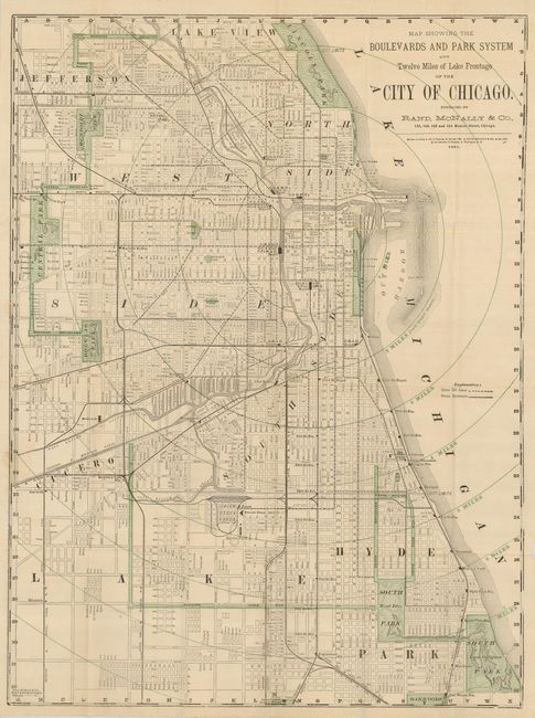
Subject: Chicago, Illinois

Period: 1881 (dated)

Publication:

Color: Printed Color

Size:
17 x 23 inches
43.2 x 58.4 cm
Download High Resolution Image
(or just click on image to launch the Zoom viewer)

Tourist oriented pocket map of Chicago. The map extends north to include Lake View and south to show Hyde Park and South Park. There are green overprinted circles each mile, centered on the downtown district. All streets are named and important places including railway stations, the exposition building, etc. are located. The map folds into printed wrappers titled, "Rand, McNally & Co.'s Historical Description and Guide Map of Chicago with a Complete Street and Avenue Guide to the Entire City." Includes 53 pages of text and ads useful to the tourist.

References:

Condition: A

Map has archival tape repairs on verso of some fold intersection splits. Text, map detached from lightly soiled wrappers.

Estimate: $140 - $180

Sold for: $210

Closed on 2/20/2008

Archived