Subject: Exploration and Surveys, Western United States
Period: 1855 (published)
Publication: HR Ex. Doc. No. 91. 33d Cong., 2d Sess.
Color: Printed Color
Size:
9.5 x 11.8 inches
24.1 x 30 cm
Volume II consists of several reports, each containing interesting and detailed accounts of daily observations by the exploring parties. The various reports are as follows:
(1) "Report of Explorations for a Route for the Pacific Railroad, by Capt. J.W. Gunnison, Topographical Engineers, near the 38th and 39th Parallels of North Latitude, the Mouth of the Kansas River, Mo., to the Sevier Lake, in the Great Basin." The report was submitted by Lt. E.G. Beckwith as Capt. Gunnison was killed during the expedition. 128 pages with 11 colorful lithograph plates.
(2) "Report of Explorations for a Route for the Pacific Railroad, on the Line of the Forty-First Parallel of North Latitude" by Lt. E.G. Beckwith. 132 pp, four geological plates, and Report on the Botany of the Expedition: by John Torrey and Asa Gray, with ten botanical plates.
(3) "Synopsis of a Report of the Reconnaissance of a Railroad Route from Puget Sound via South Pass to the Mississippi River." by Fred. W. Lander. 45pp.
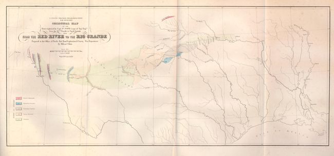
(4) "Report of Exploration for a Route for the Pacific Railroad near the Thirty-Second Parrallel of North Latitude, from the Red River to the Rio Grande, by Brevet Captain John Pope, corps of topographical Engineers." 185 pp, ten botanical plates, and "Report on the Geology of the Route", 50pp, with map Geological Map… from the Red River to the Rio Grande… and a profile of Geological Section... from Preston to the Rio Grande.
(5) "Report of Explorations for that Portion of a Railroad Route, near the Thirty-Second Parrallel of North Latitude, Lying between Dona Ana, on the Rio Grande, and Pimas Villages, on the Gila." By Lieut. John G. Parke. 28pp.
(6) "Extract from Report of a Military Reconnaissance, Made in 1846 and 1847", by Lieut. Col. W.H. Emory. Regards area lying between the mouths of the San Pedro and Gila Rivers. 22pp. 4to. Complete. Original leather covers rebound in early marbled papers. Original spine.
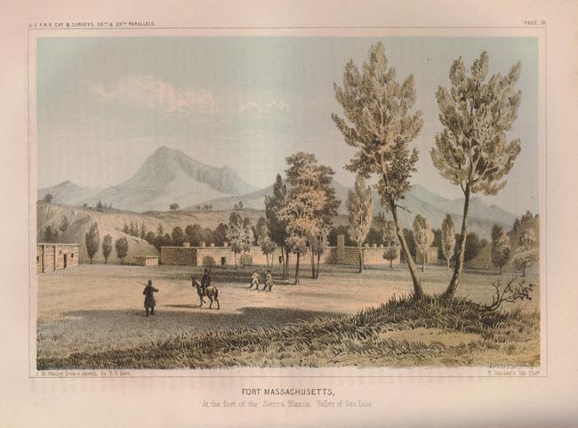
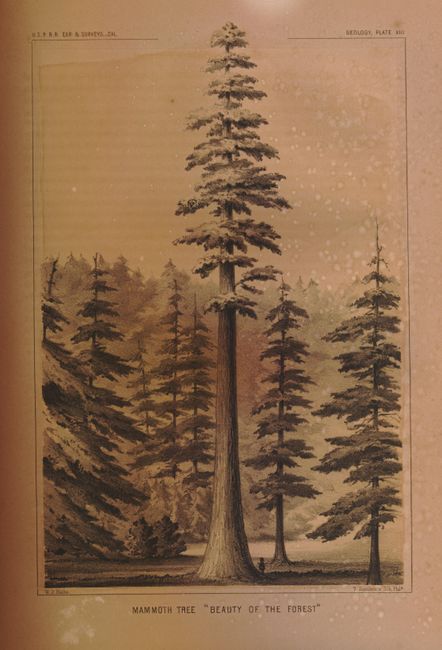
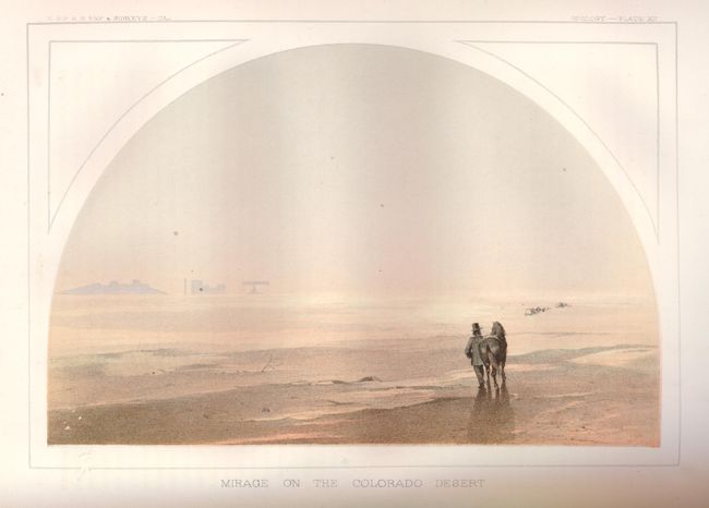
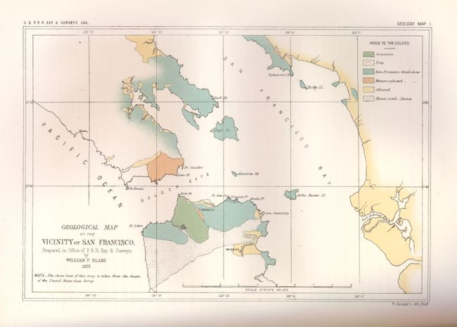
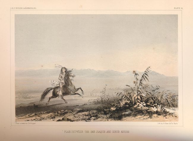
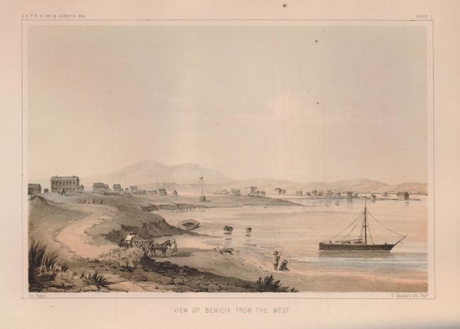
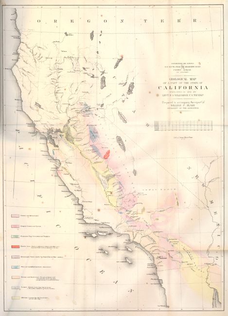
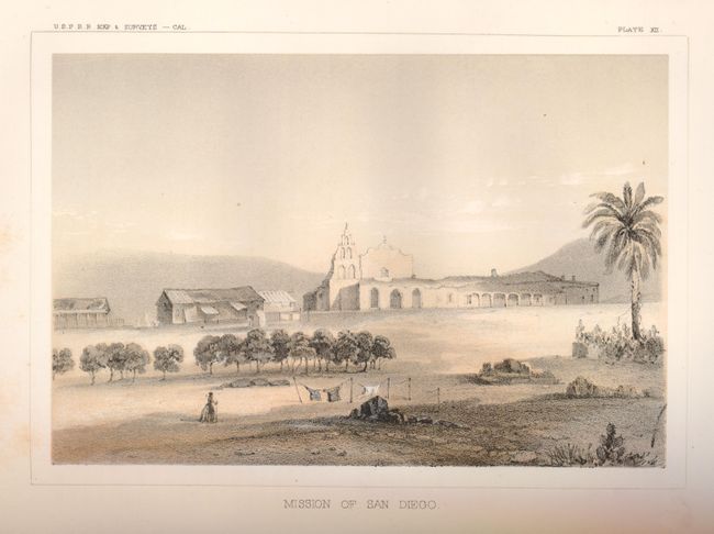
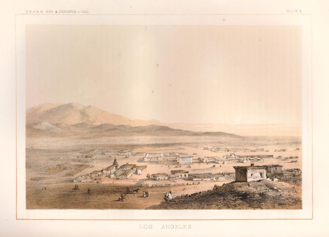
For those interested in California, Volume V is a very important volume of the "Pacific Railroad Surveys". The text provides an interesting and informative daily record of activities and observations of the exploring party. Accompanied by 13 colorful lithographs featuring San Diego, Los Angeles, Benecia, etc., and twelve smaller wood engravings in the text. The lovely tinted lithograph of LA is the first published depiction of Los Angeles. The plaza is on the left with the San Gabriel Mountains in the background. At right foreground on the hill is the former Mexican jail. Our Lady of the Angels church is at center. Chapter XX has six profiles showing the geology of the region and an important and a colorful Geological Map of a Part of California by Lt. R.S.. Williamson. 370 pages. 4to. Complete. Original leather covers rebound in early marbled papers. Original spine.
References:
Condition: A
Contents of each volume are good to very good with some minor age toning. Map in Vol. V has some small fold splits. Both volumes have been rebound, but retain their original spines. Contents are tight, spines and covers are a bit worn with minor splitting along hinges. Book plate pasted down inside each front cover.