Subject: Africa
Period: 1800-1860 (circa)
Publication:
Color:
A varied group of maps showing Africa during the 19th century.
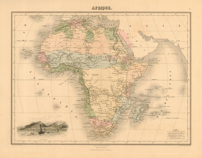
1) Afrique is nicely engraved with excellent detail, nice original wash color and a lovely vignette of St. Helene. By A. T. Chartier, Paris, c. 1860. Short split repaired on verso with archival tape. Grade A. ( 15 x 11").
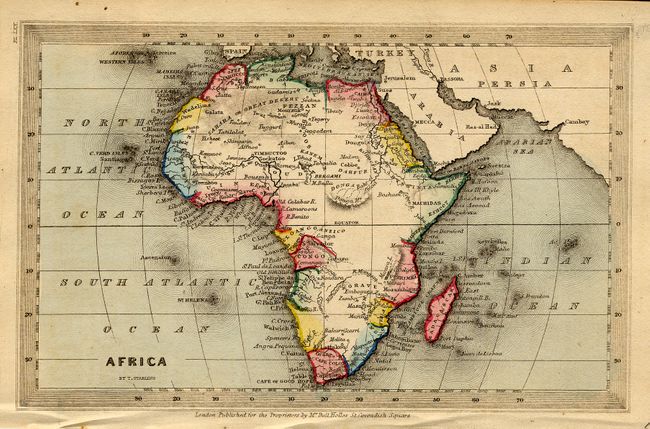
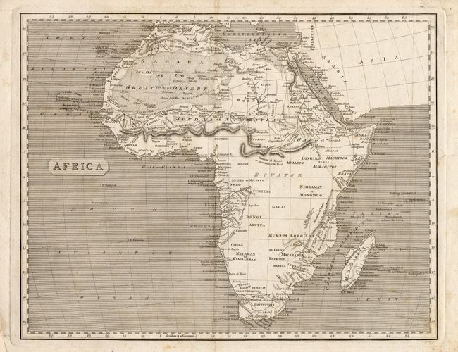
2) Africa is a charming miniature map with bold color and excellent coastal detail by Thomas Starling, London, circa 1835. Hinge remnants on verso. Grade A. 5.5 x 3.5").
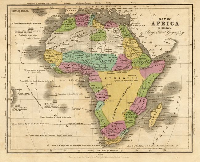
3) Map of Africa To Illustrate Olney's School Geography. Interesting map with a description of the ship Belle Poule's journey back to France from St. Helene with the remains of Napoleon in 1840. Published by D. F. Robinson & Co., 1829. Nice original wash color on a sheet with light toning and soiling. Grade B+ (9.5 x 7.5").
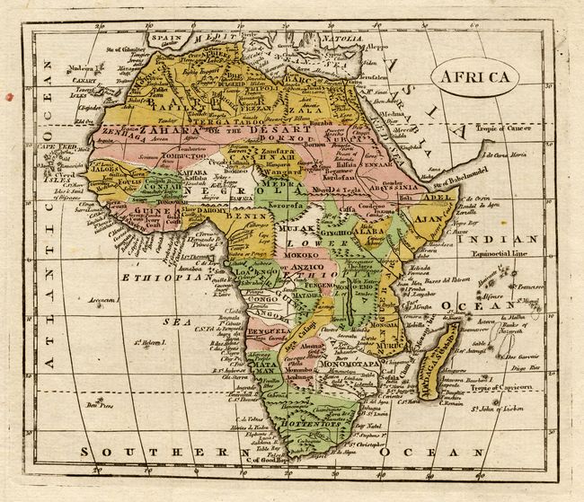
4) Africa is a crisply engraved small map filled with place names. The source of the Nile is placed more correctly, and there is a note of a tribe near the Rift Valley that are Men-Eaters. Anonymous, hand colored, circa 1860. Grade A. (7.8 x 6.8").
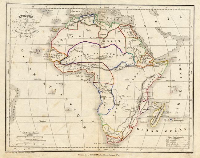
5) Afrique pour la petite Geographic methodique & le Manual de Geographie. Shows the Mountains of the Moon. Except for major cities and rudimentary topography, the continent is largely blank. Published by L. Hachette in Paris, 1835. Some light soiling. A fold split has been repaired with tape on verso. Grade B (11 x 8.5").
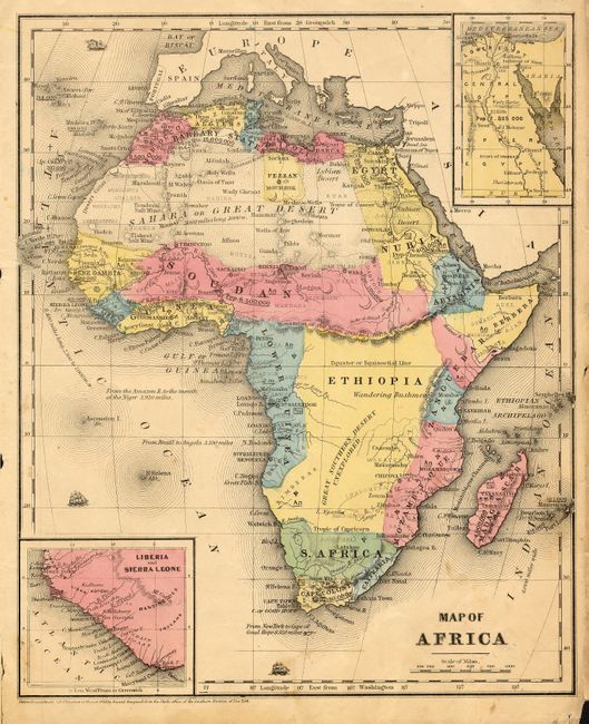
6) Africa is crisply engraved with excellent detail, circa 1800. This anonymous, black and white map shows the Mountains of the Moon named also Mounts al Komri. . There is some scattered foxing. The margins have some tears and fold splits repaired with archival tape on verso. Grade B+ (12.3 x 9.8").
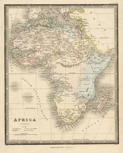
7) Africais quite detailed with numerous placenames, villages, rivers, etc. Shows the Mountains of the Moon, named also the Djebel Gumhr of the Arabs. Created by James Wyld, London, circa 1840, with original hand color. Nice impression. Grade A. (8.5 x 10").
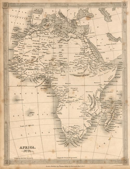
8) Africa. Nicely engraved with a lovely border, drawn and engraved by Alex Findlay and published by Thomas Kelly in London, dated 1843. Some soiling and foxing. One short edge tear repaired with archival tape on verso. Grade B. (7.8 x 10").
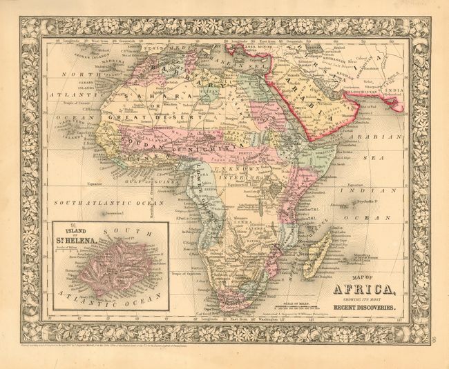
9) Map of Africa, Showing Its Most Recent Discoveries is a beautifully engraved example with a decorative floral border and an inset of the Island of St. Helena. Published by S.A. Mitchell, Philadelphia, dated 1860. Nice original hand color on a sheet with scattered foxing. Grade A. (13.3 x 10.5").
10) Africa. Crisp engraving on bright paper, with lovely original color and excellent detail. Shows the mythical Mountains of the Moon, as well as much other detail. Drawn by J. Archer, and published by H. G. Collins, London circa 1840. Faint foxing in lower margin. Grade A+. (11 x 9").
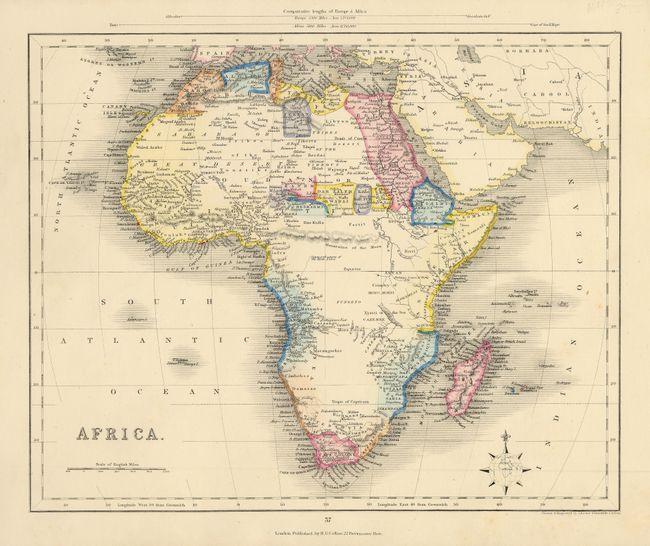
11) Map of Africa. Handsome example with ships in the sea and an inset of Liberia and Sierra Leone and another of the Nile Delta. David Burgess & Co., London, 1853, original hand coloring on a sheet with some chipping on edges. Left binding edge a bit ragged. Grade B.+ (8.5 x 10.3")
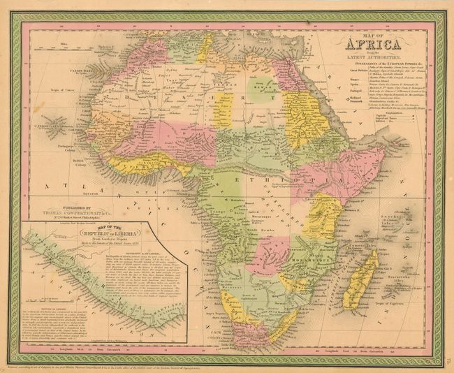
12) Map of Africa from the Latest Authorities. Terrific map with rich color and excellent detail. Includes an inset of the Map of the Republic of Liberia, which has just been formally established in 1847. Published by Thomas, Cowperthwait, Philadelphia, dated 1850, hand color. A couple spots of foxing. Two short edge separations repaired with archival tape on verso, and some hinge remnants on the verso. Grade B+ .(15 x 12.3").
References:
Condition:
See individual descriptions.