Subject: Germany and Central Europe
Period: 1623-1810
Publication:
Color: Hand Color
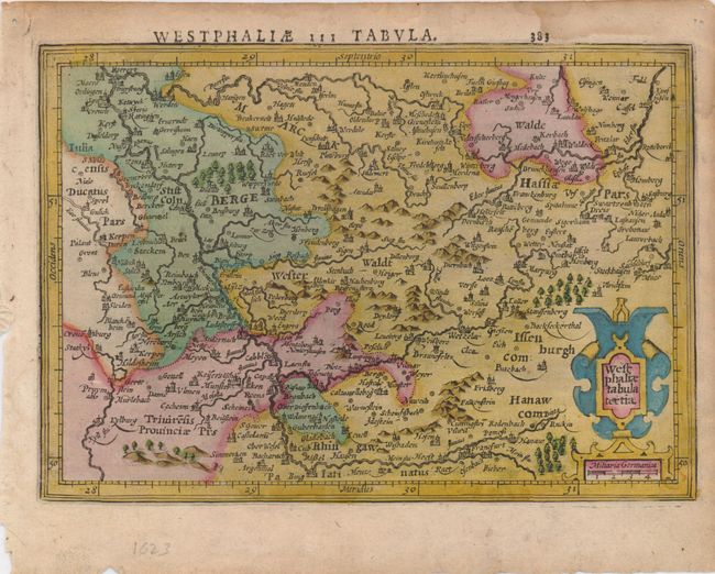
1) Westphaliae Tabula tertia is from the Mercator/Hondius Atlas Minor published in 1623 in full original color (7.7 x 5.5"). This small map of the North Rhein-Westphalia region is finely engraved to illustrate mountains, forests, rivers and cities. An attractive strapwork cartouche and distance scale are in lower right. Latin text on verso.
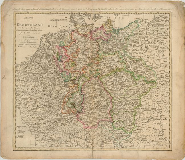
2) Charte von Deutschland nebst den agranzenden Landern… was published by Homann Heirs, circa 1810, original outline color (20.5 x 18.4"). This detailed map covers Germany and extends to include the Czech Republic and Poland with the Baltic Sea at the top and the Venetian Gulf at the bottom.
References:
Condition:
1) There are some damp stains and minor soiling, mostly in margins - B+ 2) Paper edges are soiled and the corners are dog-eared and reinforced with paper. Centerfold has a split repaired with paper on verso - B.