Catalog Archive
Auction 122, Lot 56

"Arctic Regions", Fullarton, Archibald & Co.
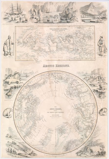
Subject: North Pole

Period: 1856 (dated)

Publication: Royal Illustrated Atlas of Modern Geography

Color: Hand Color

Size:
11.8 x 18 inches
30 x 45.7 cm
Download High Resolution Image
(or just click on image to launch the Zoom viewer)

This unusual map of the Arctic features the Northwest Passage discovered by the Irish Captain Robert McClure in 1850-53. McClure was the first man to prove the existence of the Arctic passage to the Pacific. A map of Wellington Channel and Melville Island sits above the polar depiction, which is also surrounded by lively vignettes of Eskimos, seal hunting, a polar bear, walruses, and other scenes of exploration.

References:

Condition: B

Professionally backed with paper to strenthen the damp stained paper and fill loss of upper right blank acorner.

Estimate: $200 - $275

Sold for: $150

Closed on 12/5/2007

Archived