Catalog Archive
Auction 122, Lot 433

"Carte Reduite de l'Ocean Occidentale Comprenant…", Depot de la Marine

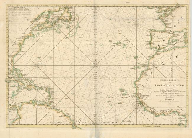
Subject: Atlantic Ocean

Period: 1742 (dated)

Publication:

Color: Hand Color

Size:
31 x 21 inches
78.7 x 53.3 cm
Download High Resolution Image
(or just click on image to launch the Zoom viewer)

Large attractive sea chart of the Atlantic Ocean extends from Newfoundland and Ireland south to Africa and the northern tip of South America with good detail of the coasts and the Caribbean Islands. The map is crossed with rhumb lines and oriented with a simple compass point at center. This chart was engraved by Dheulland and produced for Le Comte de Maurepas, the Ministre de la Marine.

References:

Condition: B

A dark impression on a thick sheet with some scattered foxing and soil. A hole just south of the Tropic of Cancer has been filled. Some repairs in the lower margin of the map just touch the border.

Estimate: $450 - $350

Sold for: $850

Closed on 12/5/2007

Archived