Subject: Oregon
Period: 1890-92 (dated)
Publication: H. Ex. 28 & 38, 52nd Cong., 1st Sess.
Color: Black & White
Four large folding maps with the same main title that provide in great detail the plan to dredge and dam the rivers to make Portland more accessible to larger ships. Major Handbury supervised the survey and published the 1892 report proposing the creation of a 25 foot deep ship channel from Portland to the Pacific Ocean at the treacherous Columbia Bar near Fort Stevens. Most of Handbury's recommendations were not implemented for a couple of decades. These highly detailed maps are filled with soundings and other navigational information. Each map has a second title as noted below.
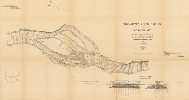
1) Willamette River Oregon in the vicinity of Ross Island surveyed under the Direction of Major Tho's H. Handbury by JM Clapp Ass't Eng'r October 1890, 38" x 21". It shows a portion of the Columbia River primarily focused on Ross Island and East Island. Shows the planed dredging and proposed dyke just upstream of the island. Locates Sellwood, the old water works and a few unnamed buildings along the shore. With profile details of the dyke below. This map does not share the common title and shows as Document #28. Some long splits along fold lines.
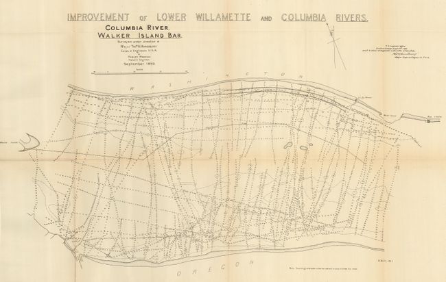
2) Columbia River , Walker Island Bar...September 1890., 26" x 17.5". This chart details the Columbia River from Bush Landing down stream to Walker Island Bar. Locates Mount Coffin, la du Wharf, and the Rinearson's Slough. Very lightly toned along folds.
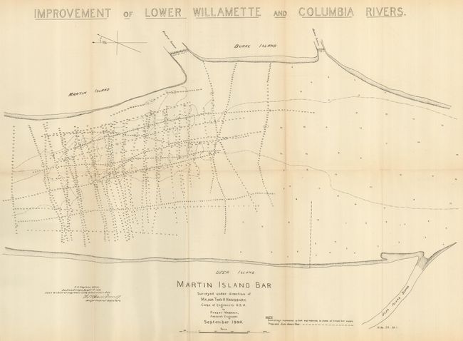
3) Martin Island Bar...September 1890., 23" x17". This shows the Columbia River as it flows between Burke and Martin Islands on the Washington side, and Deer Island on the Oregon side. Locates the Deer Island, Martin Island, and Burke Island sloughs. A little fold toning and one fold intersection split.
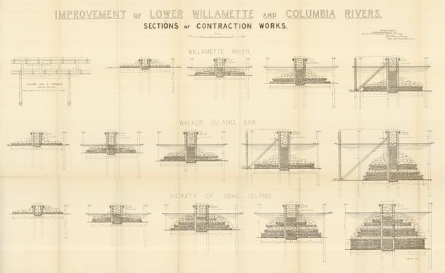
4) Sections of Contraction Works, 35.5" x 22.5". This large sheet contains 15 large scale cross-sections of the proposed dams. Each is extremely detailed, showing individual timbers and rocks. A trace of fold toning and some short splits.
References:
Condition: B
See description.