Subject: Ohio
Period: 1874 (dated)
Publication:
Color: Hand Color
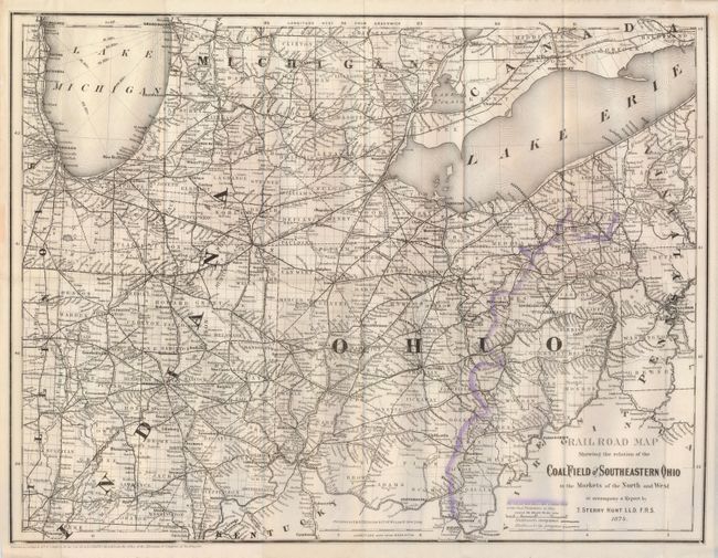
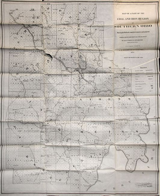
These maps were published in and to "accompany a Report by T. Sterry Hunt." The former is a precisely engraved map that includes parts of Indiana, Michigan, Illinois and Pennsylvania. The coal fields are indicated on the map with hand coloring on the otherwise uncolored map. Measures 21.3" x 16.5", folding as issued. The later map is bound into the booklet at back. It details the mineral areas in great detail at a scale of two miles per inch. The legend identifies railroads, both complete and under construction, canals, county seats, townships, furnaces, etc. This uncolored map (28.5 x 35") by Isaac B. Riley was drawn by D.W. Curtin to accompany the report. Accompanied by Hunt's scarce pamphlet, 6" x 9.5", titled "The Coal and Iron of Southern Ohio Considered in Relation to the Hocking Valley Coal Field and Its Iron Ores…". Published in Salem, Mass., 1874. Hunt promoted the Ohio coal boom which lasted from 1880 to 1920. A scarce issue complete with both maps.
References:
Condition: B+
The former is nearly very good with just a short marginal split along central fold and some weakness or splits along other folds. The later is on thin banknote style paper, folding as issued. One puncture tear near center, clean without loss. Otherwise clean copy in very good condition. The covers are toned with some edge tears and stain from old label. Contents are very good to fine.