Subject: Hawaii
Period: 1897-1906 (dated)
Publication:
Color: Printed Color
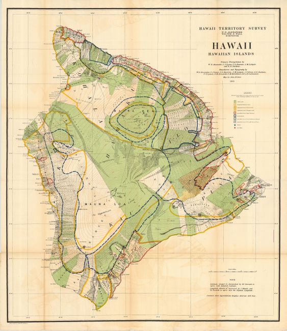
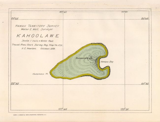
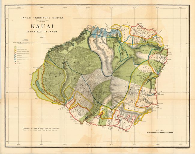
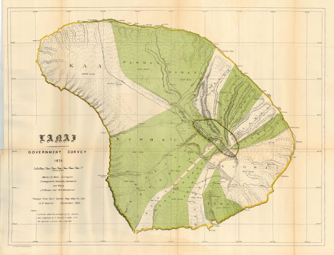
A terrific collection of maps of the Hawaii Territory as surveyed by W.D. Alexander and Walter E. Wall. Each is filled with colorful details including the location of Public Lands, Homestead Settlement Tracts, Grazing Lands, Pineapple Lands, Sugar Plantations, Forest Reserves, Forest Lands, Wet Lands, and more. The maps are stamped on verso 1 through 9. Each colored map features bright original color. Lot includes the following maps:
1) Hawaii Hawaiian Islands. 1901 (31.5 x 36"). Some offsetting and a few fold intersection splits. Light fold toning with one area more toned and with a split.
2) Kahoolawe. 1906. (6.5 x 4.8"). Clean and bright example. Upper margin, away from image, with paper laid in.
3) Kauai Hawaiian Islands. 1903 (30 x 23.4"). A little offsetting and toned along one fold.
4) Lanai Government Survey 1878 / 1906. (26 x 19.6"). A little offsetting and very lightly toned at a fold.
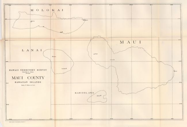
5) Maui County Hawaiian Islands. Simple black and white outline. (16.7 x 11"). Black and white map. Very good less some faint fold toning.
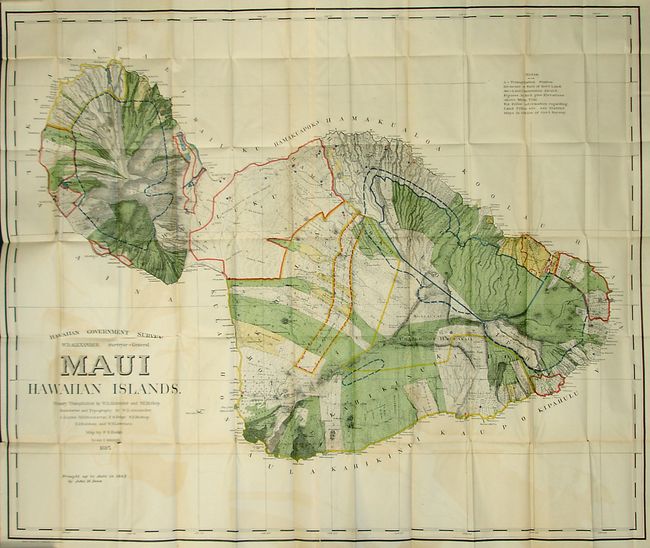
6) Hawaiian Government Survey. W.D. Alexander Surveyor-General. Maui Hawaiian Islands. 1895 / 1903 (52 x 43.5"). A spectacular chart originally drawn in 1885, updated to 1903. With a little fold toning in blank areas and some offsetting. A few fold intersection splits as found on a map of this size.
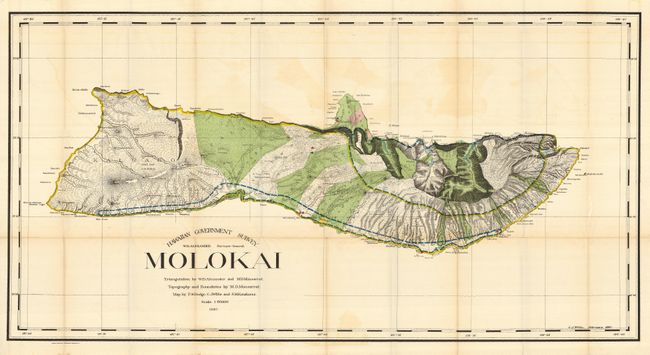
7) Hawaiian Government Survey. W.D. Alexander Surveyor-General. Molokai 1897. (48 x 25"). This beautifully colored has a little light offsetting visible in blank areas and some small fold intersection splits along one fold.
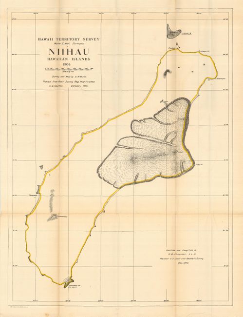
8) Niihau Hawaiian Islands. 1904 / 1906 (19 x 25.3") Colored chart but with little detail outside of the lava flows surrounding Puulua, Kaeo, Paniau and Pualae. With a little light offsetting visible in blank areas and some toning and small fold intersection splits along one fold.
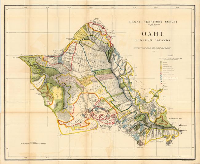
9) Oahu Hawaiian Islands. 1902. (33 x 27") A most detailed and spectacularly colored chart of the island. Some light offsetting visible in blank areas and a few small fold intersection splits along one fold with light toning.
Together a matched lot of nine maps.
References:
Condition: B+
See individual condition statements above.