Subject: San Francisco, California
Period: 1849 (dated)
Publication: Senate Ex Doc 18, 31st Cong 1st Sess.
Color: Hand Color
Size:
19.5 x 25 inches
49.5 x 63.5 cm
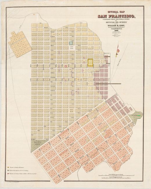
This is a seldom offered city plan of a newly-established San Francisco. Planned tracts are shown extending into the bay depciting the areas od landfill extension. The map is filled with excellent detail, including individual lots numbered and many streets named. Some of the locations named include the Yerba Buena Cemetery, a Government Reserve, two Public Squares and Fort Montgomery, but no buildings are shown. There is a colored key at lower left identifying a grant to Senora Briones, the claims of the heirs of Col. J. A. King and a claim of Senor Pana under a Mexican Grant. Two distance scales are shown at the lower right including varas to the inch. Attributed by Howes to the report "Land Titles in California" by William C. Jones. An early view of the city that was drawn by S. W. Higgins and printed by C.B. Graham.
References: Howes #E248.
Condition: B+
A nice lithographed map with original color on the land grants that has been enhanced, with later, attractive color on the rest of the map. Issued folding, now flattened. There is a tissue repair to the upper left margin, not affecting the map, and a small repair of an invisible hole on the right neatline. There are a few minor spots of foxing, still a good example.