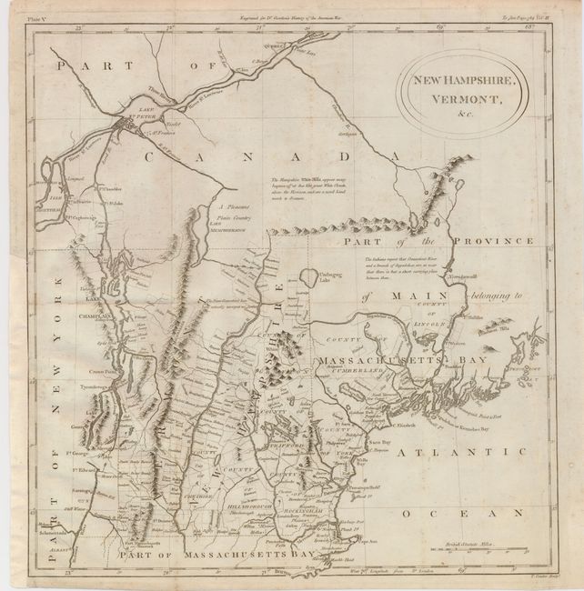
Subject: Maine, New Hampshire, Vermont
Period: 1788 (published)
Publication: Gordon's History of the American War
Color: Black & White
Size:
13.5 x 14.5 inches
34.3 x 36.8 cm
This uncommon and very interesting map details the coast from Boston to Penobscot Bay, and inland to Lake Champlain and the St. Lawrence, north to Quebec. The map shows the surveyed townships in New Hampshire and Vermont, as well as the Province of Main (Maine), then a province of Massachusetts. The map notes Pemaquid Fort, Casco Bay, Cape Elizabeth, Saco, and Wells along the coast of Maine. Lake Sebago is noted as Scebago Pond, and Lake Umbagog is placed correctly in its position on the border between New Hampshire and Maine. The White Mountains are described with a poetic note: The Hampshire White Hills, appear many leagues off at Sea like Great White Clouds, above the Horizon, and are a noted Landmark to Seamen.
References: McCorkle #788.2;
Condition: B+
Good impression on a sound sheet, with folds as issued. Paper added to the left margin to facilitate framing with a small amount of neatline reinstated in facsimile. There is some faint foxing.