Subject: Canadian Arctic
Period: 1851/53 (dated)
Publication:
Color: Hand Color
Size:
23.8 x 19.8 inches
60.5 x 50.3 cm
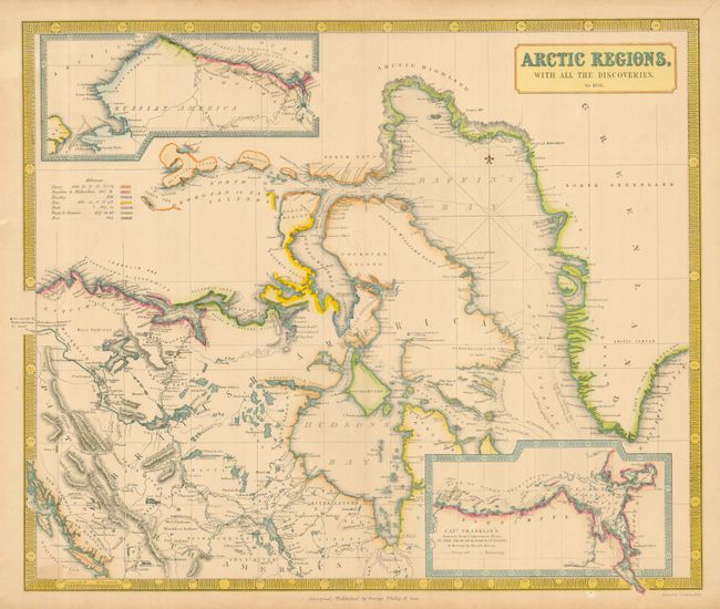
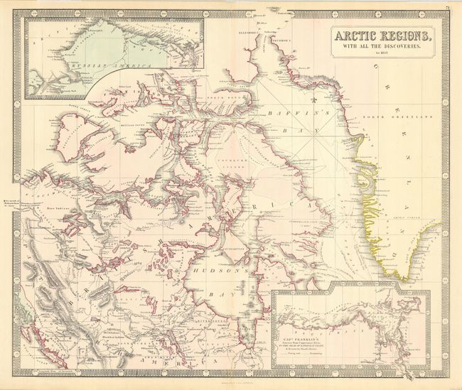
Fascinating and detailed pair of maps deal with the explorations in the Arctic near Hudson and Baffin Bays in 1851-1853. Both are inset with maps of Russian America and Capt. Franklin's Journey to the Coppermine River. The first map from 1851 has a colored key of the tracks for the explorations of Parry, Franklin & Richardson, Beachey, Ross, Back, Dease & Simpson and Rae. The coasts near where they explored are colored to correspond with their journeys. The actual tracks of Parry & Ross' ships are shown as well. The second map from 1853 shows a huge jump in the knowledge of Baffin Bay and the coast of Greenland approaching Smith Sound, as well as west across the Parry Channel. Together, these maps provide considerable information concerning Arctic exploration and the search for the Northwest Passage.
References:
Condition: B
Both maps generally good with some toning and some soft creases on map 1. Map 1 also has some short tears in the margins, not into map. There is a fold separation that has been repaired with archival tape on verso.