Subject: North America
Period: 1780-1855 (circa)
Publication:
Color:
A great group of 19th century maps showing the progress of mapping the continent with many interesting transitional configurations of states and territories.
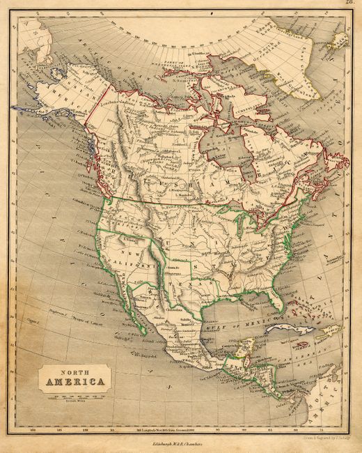
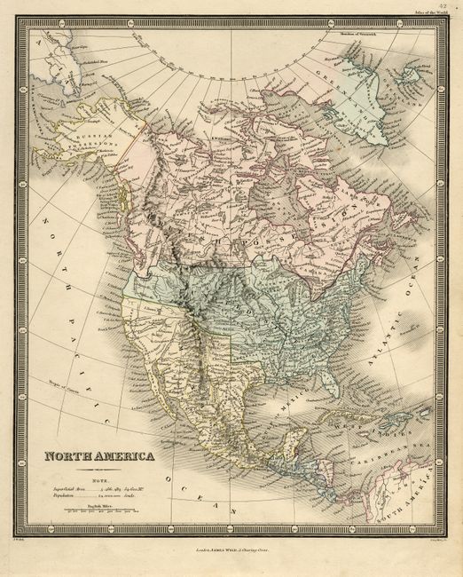
1) North America by W. & R. Chambers, Edinburgh, circa 1845. There is a large New California and an Independent Texas in its "stovepipe" configuration. Original outline color ( 8 x 10"). Some soiling and uneven toning. Grade B+.
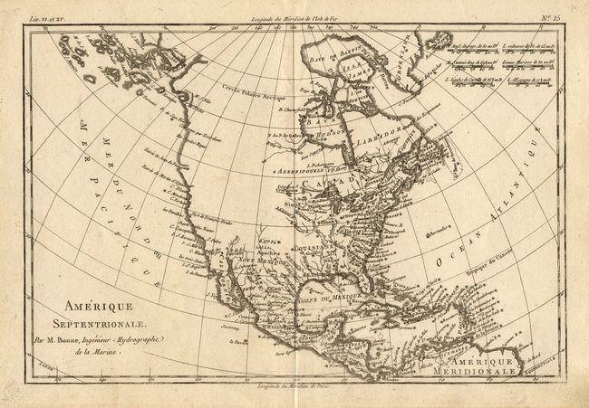
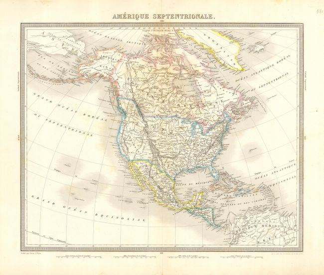
2) Amerique Septentrionale by Rigobert Bonne, Paris circa 1780. Crisp engraving. Most of the western U.S. and Canada is unexplored. Uncolored. ( 12.5 x 8.3"). Crisp impression with light surface soil in map. Grade A.
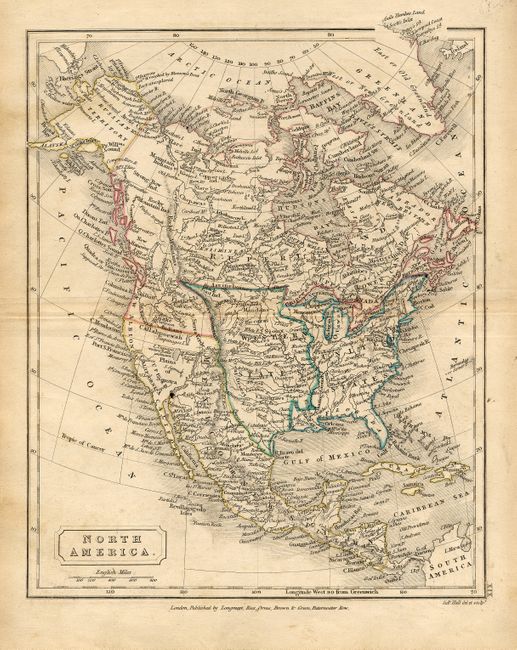
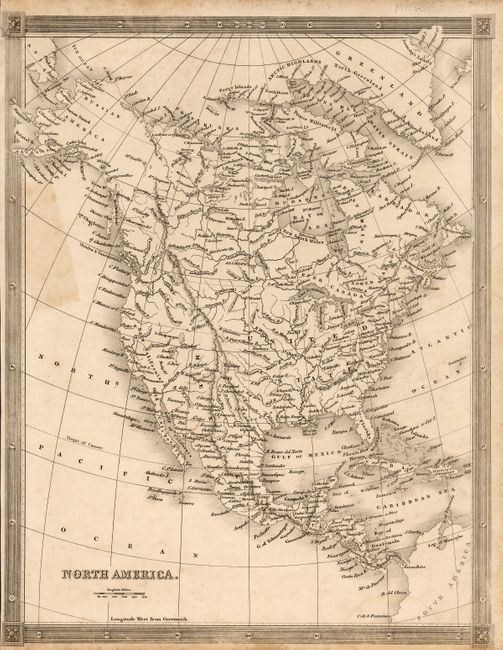
3) North America by Sidney Hall, London, circa 1828 . The "Western States" are between the Mississippi River and the Rocky Mountains, and from Texas up to the Lake of the Woods. Canada is called Rupertsland and includes the Pacific Northwest. Original outline color (7.3 x 9"). Some light soiling. Grade A.
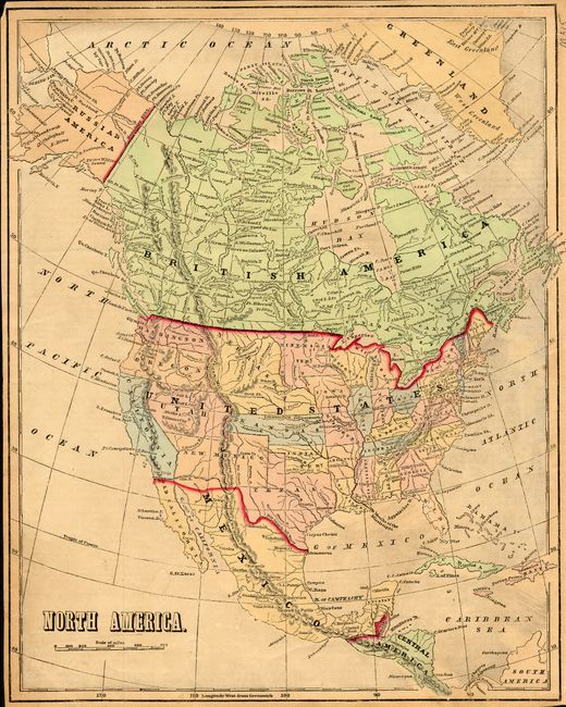
4) North America anonymous, from a school geography, circa 1855. Eastern New Mexico includes parts of Texas, Oklahoma and Colorado. Early printed color. (12 x 14.5"). Pleasant age toning. Grade A.
5) Amerique Septentrionale ,by Furne, Paris, circa 1850. Northern boundary of Oregon is at 54° latitude. Original outline color. (16.8 x 13"). Hinge remnants on verso. Grade A.
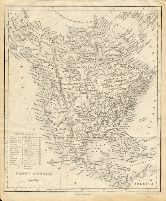
6) North America by Sydney Hall, London, circa 1852. Small map with a crisp engraving. States are shown by number. Uncolored. (6 x 7"). Some minor toning, mostly in margins. Grade A.
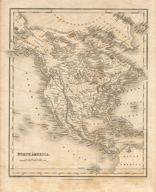
7) North America by William Hughes, dated 1848. Unusual configuration of Oregon Territory engraved to show the northern boundary at 54° Lat., but with the present day boundary shown in red, and the two halves in different colors. Original hand color (8 x 9.5"). Grade A.
8) North America by William Orr, London, circa 1830. Finely engraved with excellent detail. The western coast includes the names New Norfolk, New Cornwall, New Hanover, and New Albion. The Stony Mountains separate a large Missouri Territory from the Western Territory. Uncolored. ( 8.3 x 10"). Scattered foxing and toning. A small edge tear has been repaired with archival tape on verso. Grade B+.
9) North America, anonymous, circa 1830. Shows forts, towns, topography, etc. Uncolored (7.8 x 10"). Narrow margins with some dampstaining and toning. A small section of upper left corner repaired with paper on verso. Grade B.
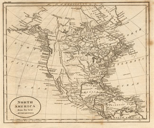
10) North America from the best Authorities, circa 1820. Crisp engraving showing the western U.S. and Canada as mostly blank. Uncolored (9 x 7.5"). Some offsetting and a couple spots. Grade B.
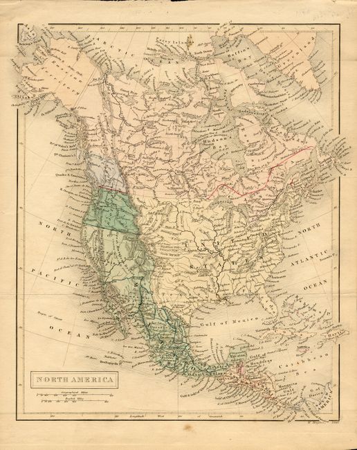
11) North America by James Wyld, London, circa 1835. The northern boundary of Oregon Territory is the Columbia River, reflecting the British claims in the region. Original hand color ( 8.8 x 10.5"). A couple spots in margin. Grade A.
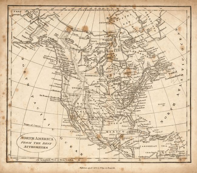
12) North America from the best Authorities by T. Tegg, London, dated 1823. Shows a prominent River of the West nearly linked with the headwaters of the Mississippi River. Uncolored. (9 x 7.5"). Scattered foxing throughout. Grade C+.
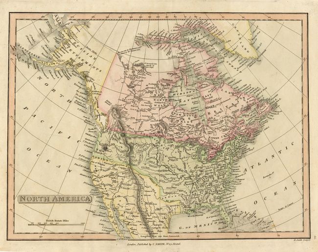
13) North America by C. Smith, London circa 1808. Shows Mexico in control of the southwestern U.S., from Texas to California. Original hand coloring ( 14 x 10.3"). Grade A.
References:
Condition:
See individual descriptions.