Subject: World & Continents
Period: 1705 (published)
Publication: Algemeene Weereldbeschryving
Color: Hand Color
Size:
12.3 x 8.8 inches
31.2 x 22.4 cm
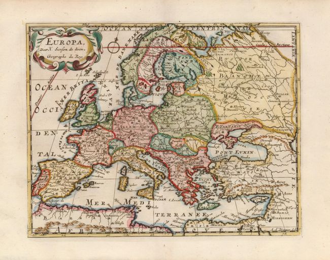
A fine set of maps from an uncommon Dutch edition of Sanson's pocket atlas engraved by Antoine de Winter. Image sizes vary slightly; dimensions given are for the page.
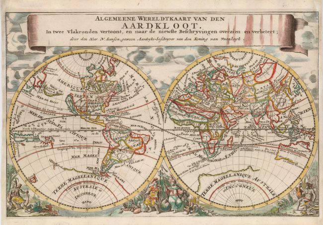
1) Algemeene Wereldtkaart van den Aardkloot is a double hemisphere map beautifully decorated with clouds at top and allegorical representations at bottom. California is shown as an island, Terre de Iesso stretches between Asia and North America, there is a bit of Nouvelle Zeelande that connects to the coastline of the mythical Terre Magellanique, and Australia is only partly mapped.
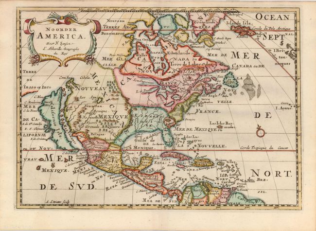
2) Noorder America is an uncommon Dutch version of Sanson's important map of North America. It shows California as an island with the indented northern coast from Luke Foxe's information. All five Great Lakes are shown but they are still misshapen and the western shores of Lake Superior and L. des Puans (Lake Michigan) are left open-ended. The Apaches are shown as the dominant tribe of Nouveau Mexique where the R. de Nort originates in a lake above Santa Fe and flows southwest to the Mar Vermeio. The British colonies are shown simply as Nouvelle Angleterre and Virginie. McLaughlin's second state, Burden's third.
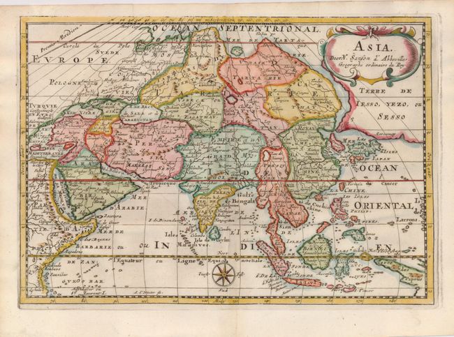
3) Asia depicts an attractive and intriguing view of the continent and the East Indies with the cartography of the larger Sanson map of 1652. This map shows a large, dramatic version of Terre de Jesso, drawn from the discoveries of the Maarten de Vries expedition of 1643. Here Sanson incorporated De Vries information by combining Hokkaido and the southern Kurils into a huge island, shown with the two place names of le Tessoy P and Matzumay. Korea is depicted as an island. This version of the map extends another 10° west to include part of New Guinea, identified here as the Terre de Papous.
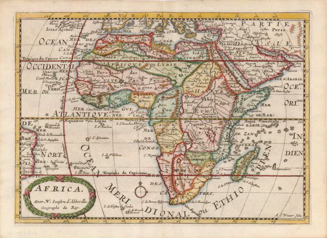
4) Africa is a detailed map of the continent that includes the Arabian Peninsula, the Canary and Cape Verde Islands, Madagascar as well as several other islands and a little of the coastline of Brazil. The Nile originates in two, spurious large lakes just north of the fictional Monts de la Lune. The title is enclosed in a wreath style cartouche.
5) Europa is a delicately engraved map of the continent with a portion of Asia and Africa.
References: 1) Shirley #553. 2) Burden (II) #545; McLaughlin #89. 3) cf Yeo #47.
Condition: B+
Most maps fine, Map 1 with facsimile of neatline and paper added on right and left margins.