Subject: Australia
Period: 1834 (published)
Publication:
Color: Black & White
Size:
23.8 x 19 inches
60.5 x 48.3 cm
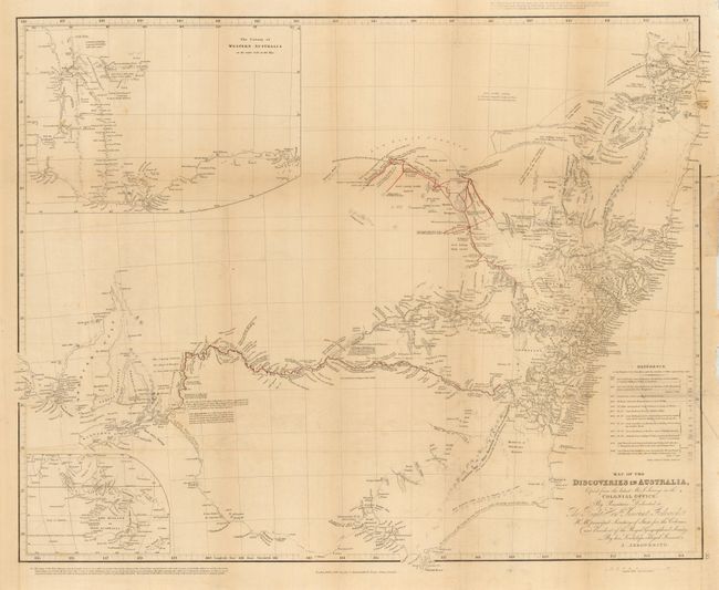
A highly detailed map of the southeastern portion of Australia from Spencer Gulf to Brisbane. Two insets are included, The Colony of Western Australia shows the area from Cape Le Grand to Perth. The second is untitled and shows a broad area from New Zealand northwest to India. A reference table lists the 12 expeditions marked on the map, with names, miles and dates. Two expeditions by Capt. Sturt are shown in red. This example is filled with detailed notes along the various routes.
References:
Condition: B+
Issued folding, now pressed and backed with archival tissue to support two fold intersection splits. Some light offsetting and toning. A 1/4" of the border at right in facsimile with paper laid in.