Subject: Africa
Period: 1800-1876 (circa)
Publication:
Color:
This is a great group of maps from the nineteenth century showing a period of intense exploration in Africa.
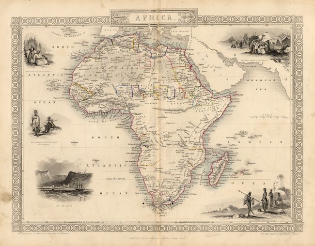
1) Africa John Rapkin, John Tallis & Co., London, circa 1850. Finely engraved with 5 attractive vignettes and a decorative border. Original outline color. (12.5 x 9.5"). Two small wormholes near bottom of map. Soiling in margins. Grade B+.
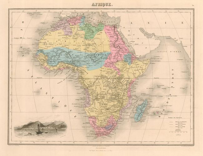
2) Afrique Desbuissons/Migeon, Paris, circa 1870. Colorful map with a crisp engraving and a vignette of Sainte Helene. Original full color. (15 x 10.8"). Light marginal toning and a few, small edge tears at right. Grade A.
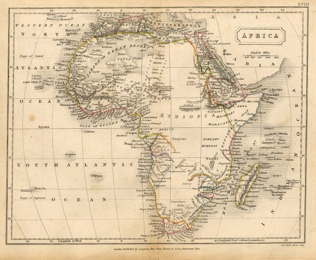
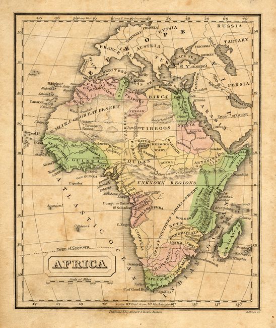
3) Africa Sidney Hall, London, circa 1826. Aethiopia takes up much of the continent. Original outline color. (9.4 x 7.4"). Light toning and a spot at left. A short centerfold split has been repaired with archival tape on verso. Grade B+.
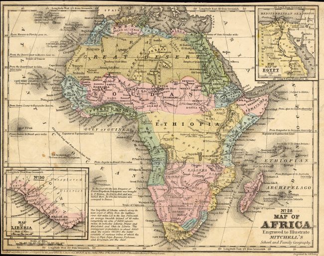
4) No. 28 Map of Africa S. A. Mitchell, 1852. Attractive map with two insets; No. 29 Map of Egypt, and No. 30 Map of Liberia. Original full color. ( 10.5 x 8"). Narrow margins with a few small spots and some pencil marks. Grade B.
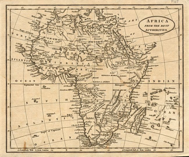
5) Africa From The Best Authorities Benjamin Baker, Islington, circa 1800. Beautifully engraved with good detail throughout. Uncolored. (9.3 x 7.8"). Toned with a couple of spots in map. Grade B.
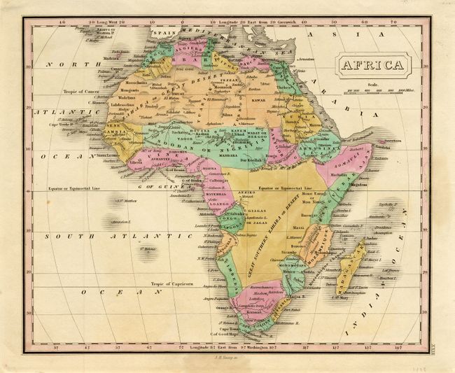
6) Africa J. H. Young, circa 1829. Colorful map with good detail. Locates the "Great Southern Zahara or Desert" in the interior south of the equator. Original full color. (9.5 x 7.8"). Light damp stain in right margin. Grade A.
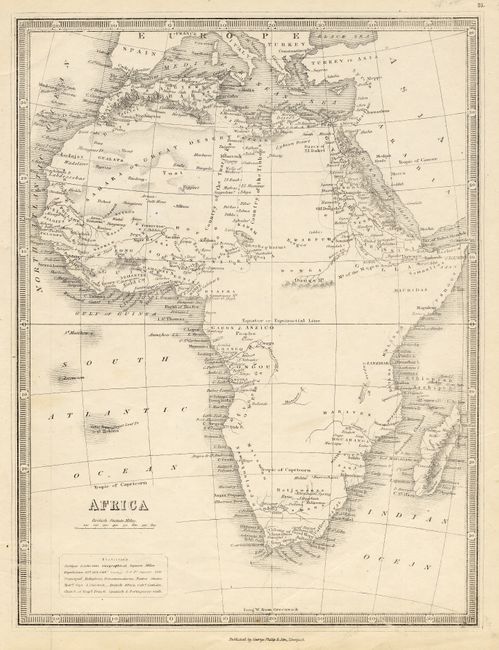
7) Africa George Phillip & Son, Liverpool, circa 1850. The interior is nearly completely blank. Uncolored. (8.8 x 11.5"). Grade A.
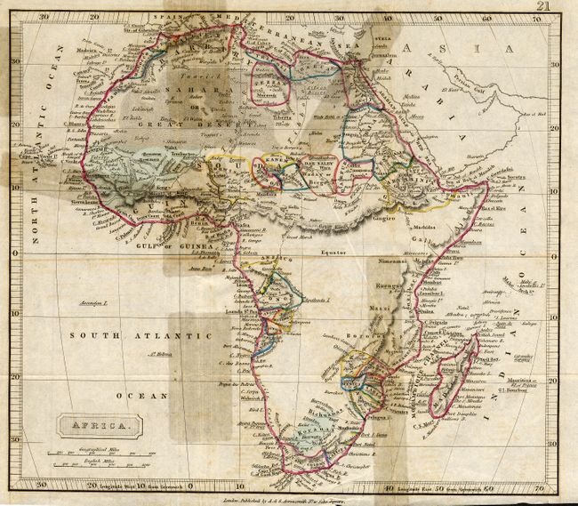
8) Africa A. & S. Arrowsmith, London, circa 1810. Original outline color. (9.3 x 8"). Several old tape repairs on verso with stains. Grade C.
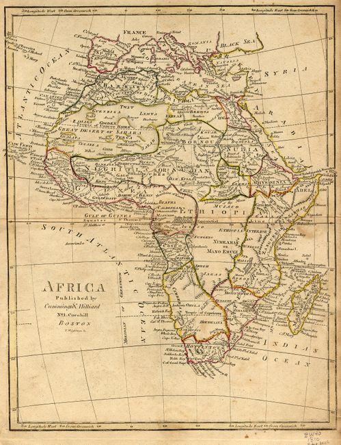
9) Africa Cummings & Hilliard, Boston, circa 1810. Shows the Mountains of the Moon. Original outline color. (8 x 10.3"). Previous owners ink notations on verso, and a section of notepaper on verso attached with wax. Some toning and soiling. Grade B.
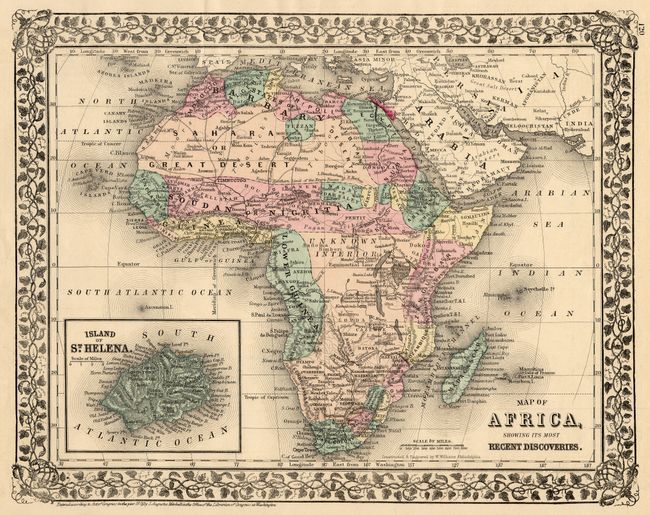
10) Map of Africa, Showing Its Most Recent Discoveries S.A. Mitchell, 1876. Colorful map with inset of the Island of St. Helena. Decorative floral border. Map of Oceanica on verso. Original full color. (10.5 x 12.5"). Two corners with small chips and one short edge tear. Grade A.
11) Africa Robert S. Davis, Boston, circa 1838. Attractive map showing "Unknown Regions" in the interior, and good coastal detail. Original full color. (5.8 x 7"). Two short edge tears repaired with archival tape on verso. Foxed and toned. Grade B.
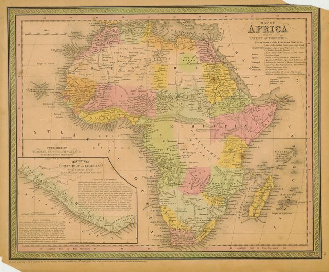
12) Map of Africa from the Latest Authorities Thomas, Cowperthwait & Co., Philadelphia, 1850. Includes the inset; Map of the Republic of Liberia. Original full color. (15 x 12"). Several edge tears and two corners with some loss, one into the border. Toned. Grade C.
References:
Condition:
See individual descriptions.