Subject: Africa
Period: 1599-1810 (circa)
Publication:
Color:
This group of maps show Africa during a period of speculation concerning the interior of the continent.
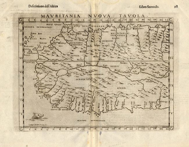
1) Mauritania Nuova Tavola, Ruscelli, circa 1599. This Italian version of Ptolemy describes many rivers, enlarged lakes and mountains. A sea monster decorates the stipple engraved sea. Ref: Norwich #313. B/W, Italian text on verso. ( 9.5 x 7.3") The map has a gray overcast due to excess ink on the printing plate. Some damp stains and filled worm tracks in blank margins - Grade A.
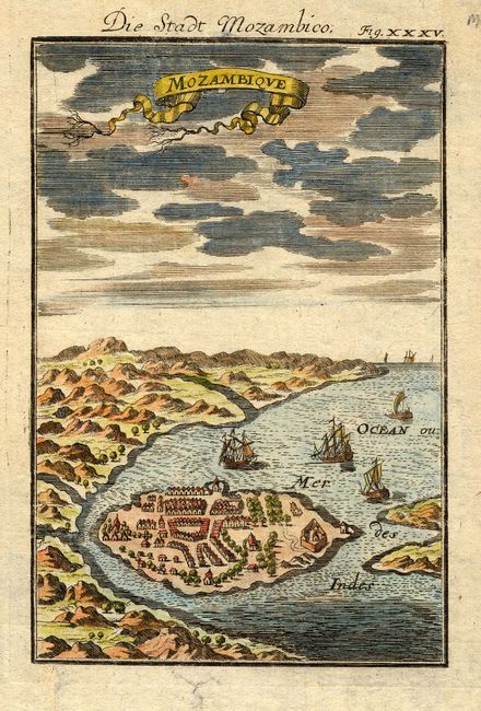
2) Mozambique by Alain Manesson Mallet, circa 1686. Charming miniature view with lovely color. Several large ships and a banner style title. Full color. (4 x 6") Grade A.
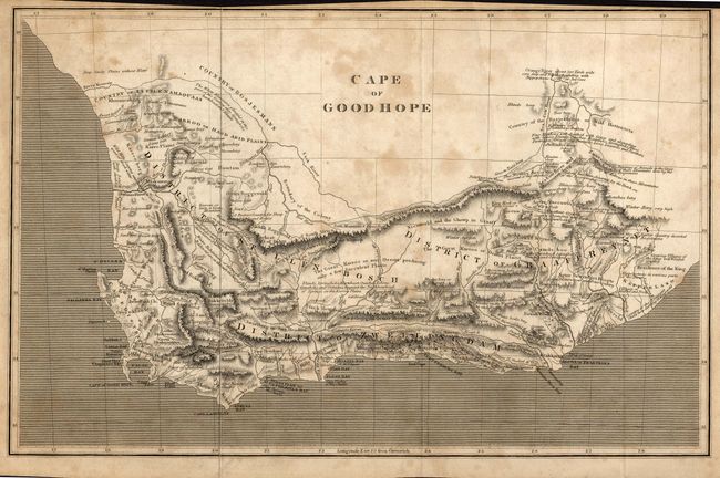
3) Cape of Good Hope, anonymous, circa 1800. Finely engraved and expertly rendered map with many notations regarding wildlife, weather and local inhabitants. B/W. (15.3 x 9.8"). Toned and foxed. Grade C+.
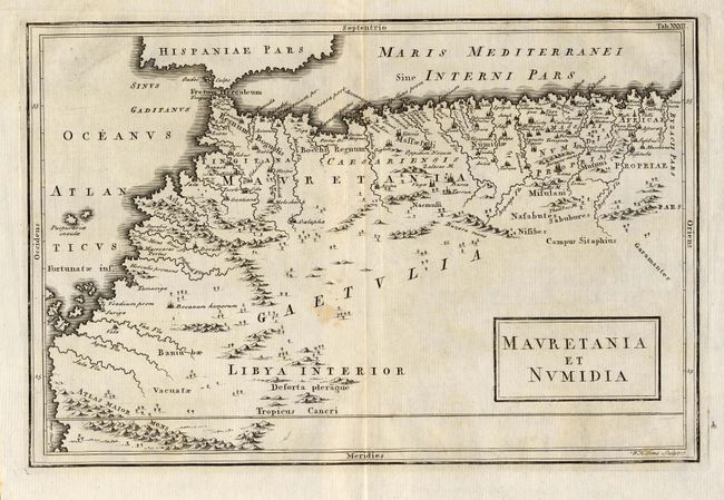
4) Mauretania et Numidia, from Geo. Antiqua et Nova, R. W. Seale, London, [1742]. Bold engraving with numerous towns, villages, rivers, etc. B/W. (12 x 8"). A bit of light toning. Grade B+.
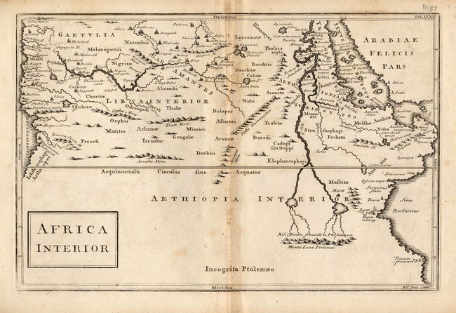
5) Africa Interior. The "Montes Lunae Ptolemaei" (Mountains of the Moon) are prominently depicted. Excellent interior details, much of it spurious, including cities, villages and topography, etc. W. H. Toms, Sculpt. B/W. (12 x 8"). Toning and foxing, mostly on fold and along edges. Short edge tear repaired with archival tape on verso. Grade B.
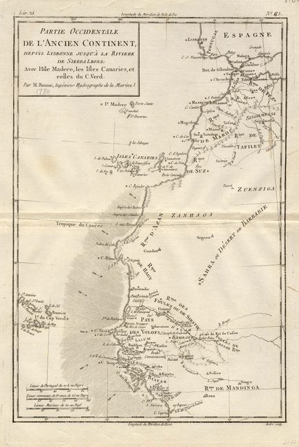
6) Partie Occidentale de l'Ancien Continent, depuis Lisbonne jusqu'a la Riviere de Sierra Leona; avec l'Isle Madere, les Isles Canaries, et celles du C. Verd.. Finely engraved map with terrific coastal detail. Three distance scales and a simple block style cartouche. Rigobert Bonne, Paris, 1780, B/W. (8.5 x 12.3"). A small amount of toning with pencil notation of date in cartouche. Grade B+.
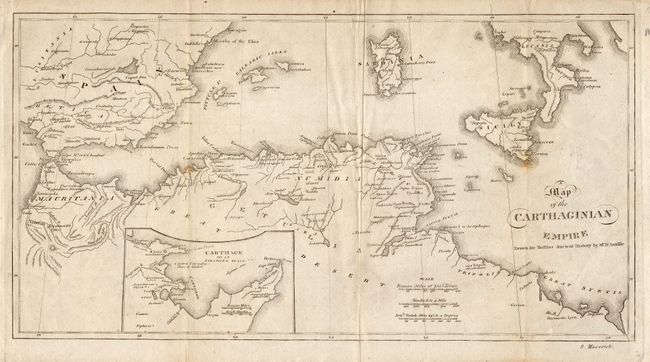
7) Map of the Carthaginian Empire Drawn for Rollins Ancient History by Mr. D'Anville circa 1810. Finely engraved with excellent detail of the coastlines. Includes an inset of Carthage. B/W. (12.8 x 6.8"). A couple small, unobtrusive spots, and some toning along edges. Grade B.
References:
Condition:
See individual descriptions.