Subject: Western Hemisphere
Period: 1655 (circa)
Publication: Newe Welt und Americanishe Historien
Color: Hand Color
Size:
17.3 x 13.9 inches
43.9 x 35.3 cm
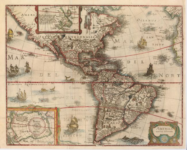
This is the uncommon, larger version of Merian's map of the Americas. Merian's bold engraving style copies the cartography of Jodocus Hondius' map. North America is depicted with a prominent Virginia and an odd New England coastline. The western coastline above California makes the continent too wide and there is only a hint of the Great Lakes. The fictitious Parime Lacus is shown in equatorial South America. Insets of the polar regions are set in strapwork cartouches, with placenames from Marco Polo on the South Pole. The map is finely decorated with a title cartouche featuring human skulls and bones to represent cannibalism and the seas are teeming with ships, sea battles and fierce sea monsters.
References: Burden #235, Tooley (Amer) p. 299.
Condition: B
Issued folding, now flattened with some repairs of a few short tears in the margin, and a repaired fold affecting the lower ship. Slightly irregular impression, still presents well.