Subject: South America
Period: 1730-1854 (circa)
Publication:
Color: Black & White
Nice group of maps detailing South America from the 18th to 19th centuries.
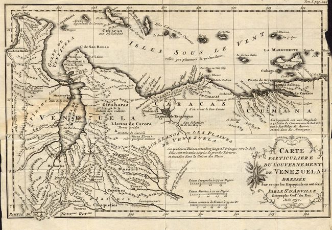
1) Carte Particuliere du Governement de Venezuela Dressee Sur ce que les Espagnols... by D'Anville, 1730. Uncolored. (11 x 7.5"). Uncommon map with excellent detail showing towns, villages, topography and more. Three distance scales and a decorative title cartouche included. Several tears repaired with tape and paper on verso. Margins are a bit chipped, and right margin with small amount of loss past border. Light offsetting. Grade C+.
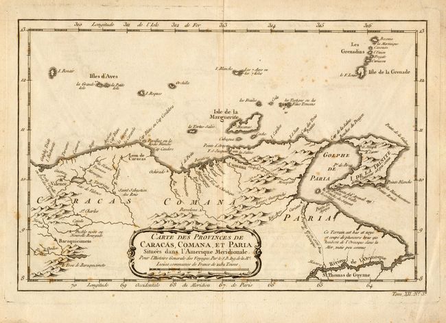
2) Carte des Provinces de Caracas, Comana, et Paria Situees dans l'Amerique Meridionale. Pour l'Histoire Generale de Voyages by Nicolas Bellin, circa 1760. Uncolored. Attractive map of the northeastern part of Venezuela, including the islands of Margarita, Trinidad and the Grenadines. The locations of numerous settlements along the Venezuelan coast are noted, including Valencia, Caracas and Cumana. Includes a number of geographical notes and a nice title cartouche. (11.5 x 7.5"). Some minor foxing and a small fold split repaired with archival tape on verso. Grade B.
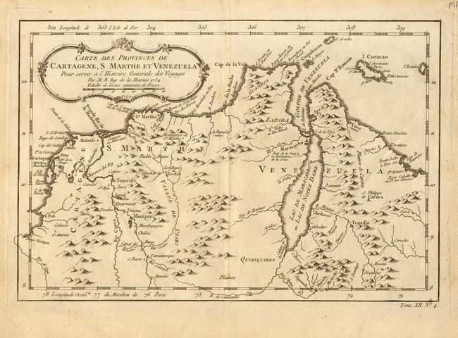
3) Carte des Provinces de Cartegene, S Marthe et Venezuela. Pour l'Histoire Generale de Voyages, by Nicolas Bellin, 1754. Uncolored. Attractive map of the northern part of Venezuela, including the Island of Curacao. Many settlements including St. Marthe and Maracaybo are named. Good coastal detail and a decorative title cartouche also included. (11.5 x 7.5"). Some light soiling, mostly in margins. Grade B+.
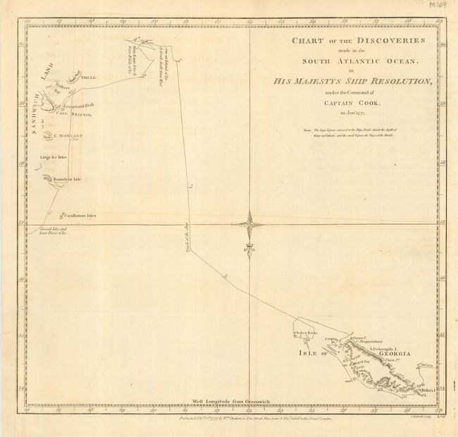
4) Chart of the Discoveries made in the South Atlantic Ocean, in His Majestys Ship Resolution, under the Command of Captain Cook , in Jany. 1775. Attractive nautical chart with relief shown by hachure. Shows the ship's tracks, and covers the area between the Isle of Georgia and the South Sandwich Islands. Oriented with north toward bottom. London, 1777. (13.5 x 12.3"). Some light offsetting. Binding edge reinforced with paper. Grade B+.
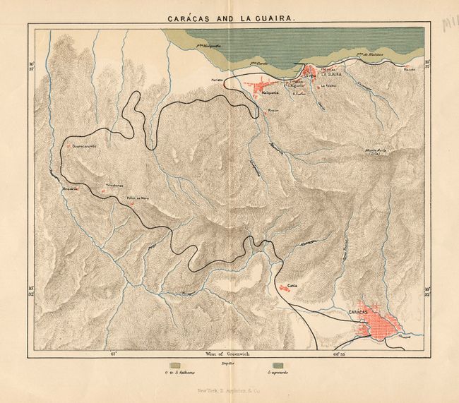
5) Caracas and La Guaira. Handsome topographical map focusing on the road between Caracas and La Guaira. D. Appleton & Co., New York. Printed color. (9 x 7.5"). A centerfold split and a couple edge tears repaired with archival tape on verso. Grade B+.
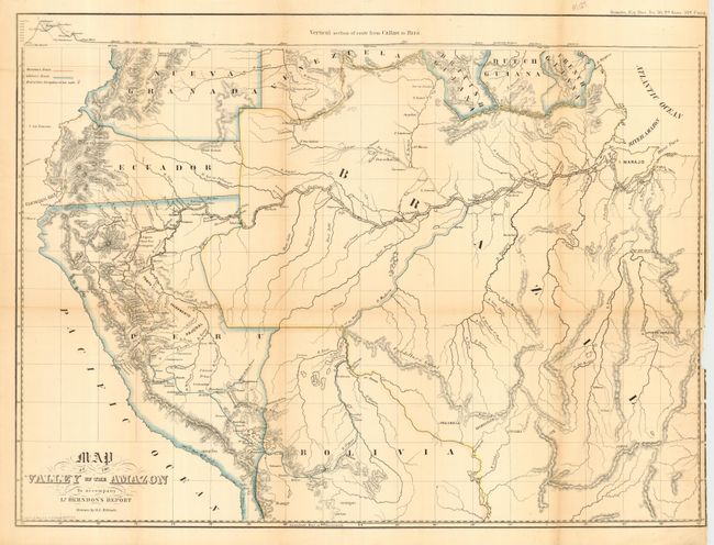
6) Map of the Valley of the Amazon to accompany Lt. Herndon's Report, [1854]. This seldom seen map details the basin and valley of the Amazon River. The range extends from the Pacific in Peru and Ecuador to the Atlantic and the mouth of the Amazon at the I. Marajo. The watershed is shown in great detail. Lieutenant Herndon made this exploration and the resulting report under the direction of the U.S. Navy Department. He journeyed through parts of Peru, Bolivia and Brazil for nearly a year. Drawn by H. C. Elliott. Vertical section of route from Callao to Para shown at top. Outline color. (23.5 x 17.5"). Toned along folds. Right margin with some loss past the border, but not affecting map. Several small edge tears and several fold splits, some repaired with tape on verso. Grade C+.
References:
Condition:
see individual descriptions.