Catalog Archive
Auction 121, Lot 377

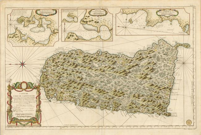
"Carte de l'Isle de Sainte Lucie Dressee au Depost des Cartes et Plans de la Marine…", Bellin, Jacques Nicolas
Subject: St. Lucia

Period: 1763 (dated)

Publication: Hydrographie Francoise…

Color: Hand Color

Size:
34.5 x 22 inches
87.6 x 55.9 cm
Download High Resolution Image
(or just click on image to launch the Zoom viewer)

A handsome, large-scale map of St. Lucia inset with three maps; Plan du Port du Carenage, Plan de Cul de Sac des Roseaux, and Mouillages du Grand Islet et du Choc, each with soundings and their own decorative cartouches. The main map is filled with charming pictorial representations of plantations, trees, and mountains. The coastal notes include anchorages as well as the location of an ancient French fort. The map is decorated with an ornate title cartouche and a large compass. The seal of the Depot de la Marine in the lower right with a price of Cinquante Sols.

References: Tooley (MC#81) #9.

Condition: B+

A superb impression on a strong sheet with a little faint damp staining in the map at top and on centerfold.

Estimate: $750 - $850

Sold for: $550

Closed on 9/26/2007

Archived