Subject: Puerto Rico
Period: 1671-1764 (circa)
Publication:
Color: Black & White
A handsome pair of maps describing Puerto Rico in the 17th and 18th centuries.
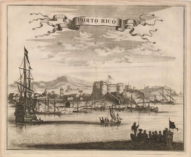
1) Porto Rico , Arnoldus Montanus, Amsterdam, 1671. (13.6 x 11"). A lively composition that depicts the importance of this well-fortified, thriving port. The foreground is filled with activity, and is highlighted by a towering galleon. This view was prepared for Montanus' important work on the New World, Die Unbekante Neue Welt.
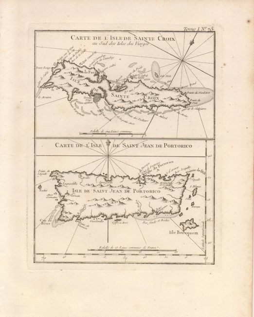
2) Carte de l'Isle de Sainte Croix… / …Saint Jean de Portorico, by J.N. Bellin from Le Petite Atlas Maritime, Paris, 1764 (6.6 x 8.5"). Two charming maps on a single sheet with St. Croix above the map of Puerto Rico. Both maps have excellent coastal detail with soundings, anchorages and shoals well illustrated.
References:
Condition: A
Both have a sharp impression with some marginal toning and scattered foxing in margins. There is faint offsetting on the Montanus view.