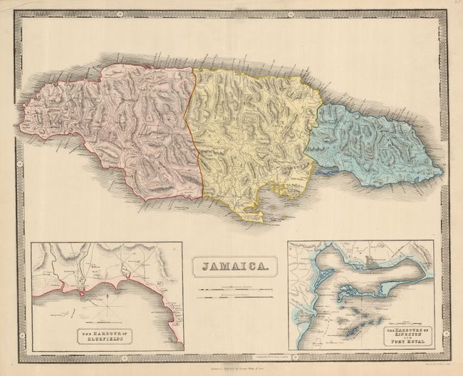
Subject: Jamaica
Period: 1850 (circa)
Publication:
Color: Hand Color
Size:
24 x 19.3 inches
61 x 49 cm
A large and colorful chart of the island showing excellent detail with parishes, towns, roads, churches and barracks. The coastal detail includes harbors, soundings, shoals, etc. This example has two large insets, The Harbour of Bluefields and The Harbours of Kingston and Port Royal. Map and insets have simple, block-style title cartouches and the map is enclosed by a strong keyboard style border.
References:
Condition: A
Centerfold has short splits at each end well away from map. An edge tear has been repaired with archival tape on verso. Upper margin is slightly creased. A couple unobtrusive spots in map.


