Subject: Cuba
Period: 1764-67 (published)
Publication:
Color: Black & White
A handsome pair of maps detailing Cuban bays in the 18th century.
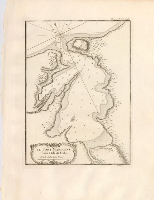
1) Le Port Marianne is a charming engraved map of today's Puerto Mariel. Soundings, rhumblines, fleur-de-lys and a rococo-style title cartouche accent the sheet. From "Le Petite Atlas Maritime", J. N. Bellin, Paris, 1764. (6.5 x 8.7"). Near fine example with bright impression and very wide margins. Wormhole in lower margin, else fine. Grade A.
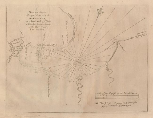
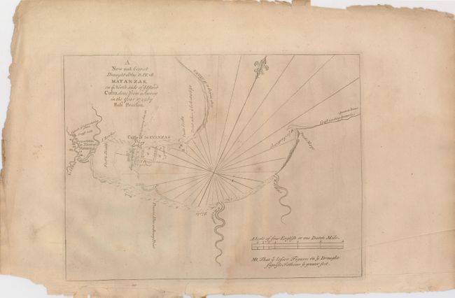
2) A New and Correct Draught of the Bay of Matanzas on ye North Side of ye Island Cuba Done from a Survey in the Year 1729 by Robt. Pearson is an attractive map with soundings, anchorages, rivers, a snuff mill and several navigational notes. The Castle of Matanzas is well shown as is the town. Located about 30 miles east of Havana, Matanzas is called the city of bridges, because 17 cross the three rivers that bound the city. Mount & Page, in the English Pilot, London, 1767. (12 x 9") Edges are rough, printer's crease into lower right, some toning and soiling, impression is light. Grade B.
References:
Condition:
See individual descriptions.