Subject: Gulf of Mexico and Caribbean
Period: 1754-87 (circa)
Publication:
Color:
A nice pair of mid-19th century maps detailing the Gulf of Mexico.
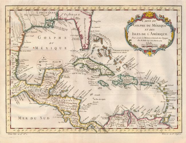
1) Carte du Golphe du Mexique et des Isles de l'Amerique is an attractive map of the islands of the Caribbean, including those parts of the United States and Mexico bordering the Gulf of Mexico, Central America, and the northern coastline of South America. Routes of several explorers are shown and many coastal place names. Delicately engraved rococo-style title cartouche decorates the map. Handcolored (14.8 x 10.8"), and published in l'Histoire Generale des Voyages by Jacques Nicholas Bellin in 1754.
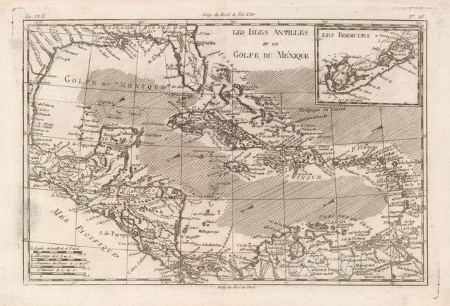
2) Les Isles Antilles et le Golfe du Mexique decribes the Caribbean, with good detail of Central America. Includes the Gulf Coast and Florida with St. Augustine, Pensacola and New Orleans named. A large inset of Bermuda is equally detailed. This map was created by Rigobert Bonne circa 1787, uncolored (12.5 x 8.2").
References: Map 1, (MCC) 96-878; Map 2, Sellers & Van Ee #1705.
Condition: B+
Map 1 on a fine piece of laid paper with folds as issued. There are a couple of printer's creases and one rust spot. Map 2 with pair of wormholes in the ocean.