Subject: World
Period: 1854 (dated)
Publication: Physical Atlas
Color: Hand Color
Size:
23.5 x 20 inches
59.7 x 50.8 cm
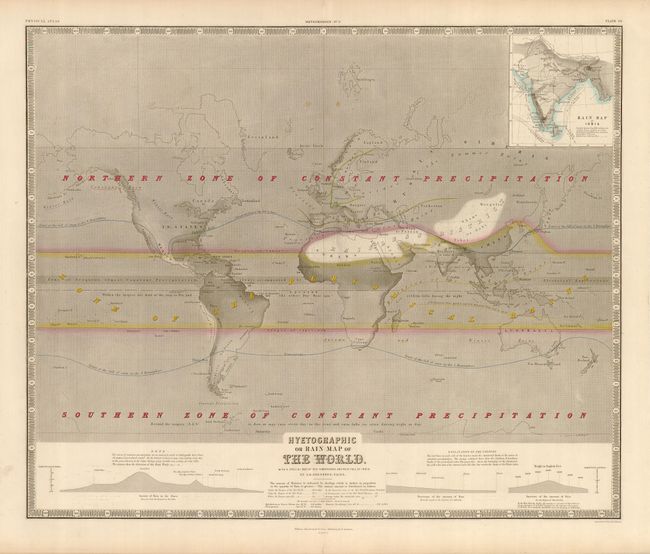
This fascinating, early thematic map meticulously notes patterns for precipitation across the entire world, with an inset map of India focused on the monsoons. The variable shading illustrates the amount of precipitation. The area on either side of the equator is noted as a zone of seasonal rain, while the northern and southern latitudes are both labeled as zones of constant precipitation throughout the year. Another band at the equator is noted as a "Zone of Frequent, almost Constant Precipitation, always accompanied by Electrical Explosions."
Keith Johnson worked in conjunction with German Heinrich Berghaus to produce the Physical Atlas, the first truly comprehensive thematic atlas. The maps from this atlas made a huge impact on cartography in general and specifically on the graphic portrayal of geographical data.
References: Robinson, pp. 64-75.
Condition: A
Overall very good. Printed on a strong sheet with lovely color and a couple of light spots near the centerfold., reinforced at top and bottom margins