Subject: California, Arizona & Baja Mexico
Period: 1825-27 (published)
Publication:
Color: Hand Color
Size:
20.5 x 18.5 inches
52.1 x 47 cm
This group of maps features the California coast from about Monterey to the tip of Baja California, and including a little bit of the Southwest. The Atlas Universel was the first atlas to present all the maps on the same scale (1: 1,641,836), with each map covering an area of approximately 20 degrees longitude (from Paris) and 6 degrees of latitude. It was also considered to be the first lithographic atlas ever published. The maps were meant to be joined together to form a huge globe measuring 7.775 meters in diameter. There was only one edition of the atlas, published in 1825-27, and the subscription list shows that only 810 copies were sold.
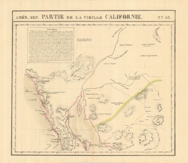
1) Amer. Sep. Partie de la Vieille Californie. No. 53 shows the coast from San Juan de Capistrano to about Santa Rosalita and Bahia de los Angeles including the north end of the Sea of Cortez and the mouth of the Colorado River, inland to Tucson (Pres. de Tubson) with many notes on the Native tribes.
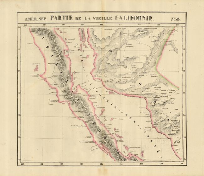
2) Amer. Sep. Partie de la Vieille Californie. No. 58 shows Baja Mexico from just north of Punta Prieta to Santa Rita and La Paz, including the Sea of Cortez.
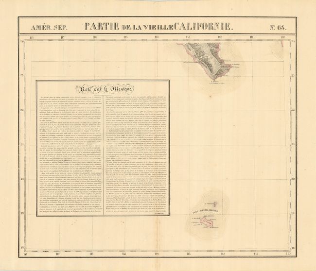
3) Amer. Sep. Partie de la Vieille Californie. No. 68 is just the southern top of Baja with Cabo San Lucas and the islands of Socorro and St. Benedict.
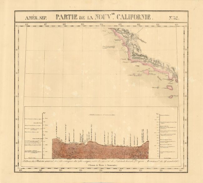
4) Amer. Sep. Partie de la Nouvle Californie No. 52 features the section of California from about Monterey to just south of Catalina Island. A chart of elevations fills the bottom of the map.
References:
Condition: A
All maps excellent with one or two tiny spots of foxing.