Subject: North Carolina
Period: 1829 (published)
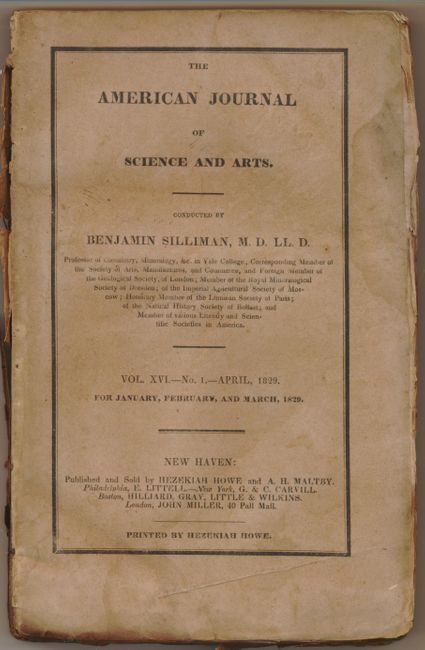
Publication: The American Journal of Science and Arts, Vol. XVI. No. 1. April 1829
Color: Hand Color
Size:
10.8 x 7.3 inches
27.4 x 18.5 cm
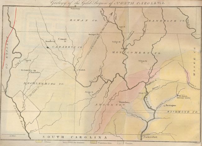
This is one of the more difficult to find American Journal of Science volumes because it contains Elisha Mitchell's map Geology of the Gold Region of North Carolina and his accompanying article. This important map appears to be the first published geological map of any part of North Carolina as it predates the earliest example listed in Marcou & Marcou's Mapoteca Geologica Americana, A Catalogue of Geological Maps of America, USGS Bulletin 7, 1884. The map covers the region of America's first gold rush that occurred during the 1820's and 1830's. Often overshadowed by the larger findings in California, gold was first discovered in the U.S. in Cabarrus County, North Carolina in 1799. This early impression still carries the plate's layout lines, which usually disappeared after a few impression.
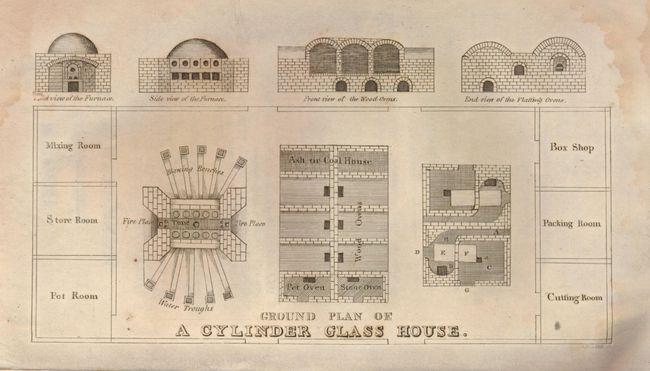
In 1853, Dr. Mitchell successfully measured the height of Mt. Mitchell, which was named for him and is the highest point in the U.S. east of the Mississippi River. Tragically, he fell to his death while attempting to re-measure the readings in 1857. Complete. 8vo. In original printed tan wraps, 216 pages with postscript, map, a plate showing the design of a glass cylinder house and six pages of advertisements. Rarely seen complete with this important map.
References:
Condition: B
Map is very good with just a hint of toning along edges. Plate has some damp staining and light foxing. Rest of the contents have light foxing, some soiling and some damp staining. Edges of most pages are a bit frayed and soiled. Covers are soiled and worn. Spine is nearly all missing, binding still tight.