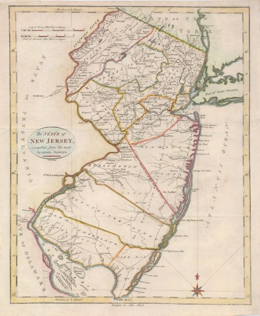
Subject: New Jersey
Period: 1796 (published)
Publication: American Atlas
Color: Hand Color
Size:
14.5 x 17.5 inches
36.8 x 44.5 cm
This is an early and important map of New Jersey from the second atlas published in the United States. It was closely copied from Samuel Lewis' map of 1795 and was engraved by David Martin. The map shows twelve counties, the division line of East from West Jersey, and provides an great view of early settlements and roads. Also included are the locations of churches, mills, and taverns.
References: Wheat & Brun #418.
Condition: B
Issued folding, now flattened with folds reinforced with tissue on the verso. The right binding side has been neatly extended to accommodate framing, repairing a minor tear in the process. A tiny hole in blank area of ocean has been professionally filled.