Subject: Midwest and Mid Atlantic
Period: 1843 (published)
Publication: Geology of New York
Color: Hand Color
Size:
32.5 x 22.8 inches
82.6 x 57.9 cm
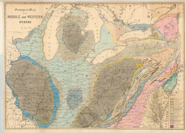
Lovely, colorful geological map by the eminent American geologist James Hall blends science and the art of cartography. Twenty-three geological formations are named and identified using hand applied colors. The map covers the region of the United States from its western boundary along the Mississippi River, east to Long Island and the Atlantic. It includes all or parts of Wisconsin, Illinois, Missouri, Kentucky, Virginia, Indiana, Ohio, Michigan, Pennsylvania, New York, New Jersey, Maryland, and Delaware. Lakes Michigan, Huron, Erie and Ontario are shown. Lithographed by Endicott of New York. A nice example of an early and scarce geological map.
References:
Condition: A
Issued folding, now flattened. Some small tissue added on verso to support fold intersections. Some faint offsetting or toning. Original binding strap attached at top left.