Subject: United States - Central Midwest
Period: 1825 (dated)
Publication: A New General Atlas
Color: Hand Color
Size:
21.5 x 17 inches
54.6 x 43.2 cm
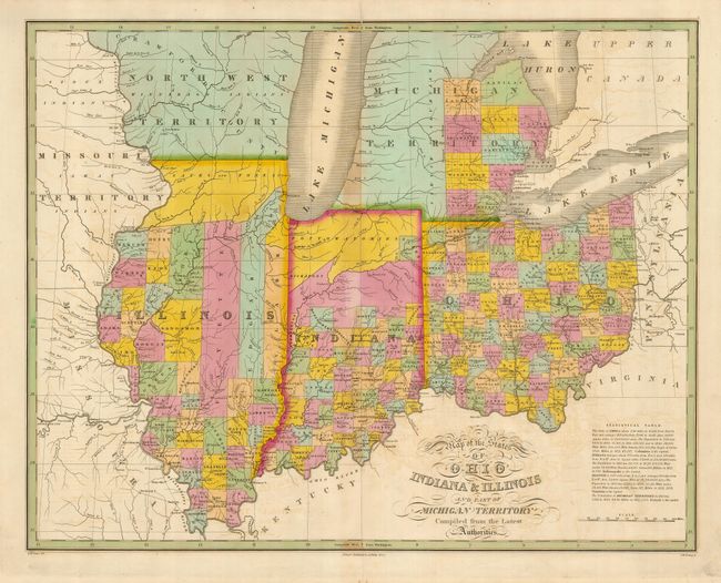
Finely's maps employ a delicate and elegant engraving style and provided extensive topographical and watershed information. He was the dominant map maker in the United States in the early 1820s into the 1830s. His atlases were very successful, outselling rival atlases by Carey & Lea, and Tanner. His maps were printed on high quality paper and were routinely corrected and updated.
Excellent, early map shows the new states of Illinois (1818), Indiana (1816), and Ohio (1803). The early Michigan Territory, (Michigan does not become a state until 1837), has only ten counties organized in the east. The Northwest Territory occupies what will become Wisconsin, and the Missouri Territory fills the land west of the Mississippi. The map notes major towns and roads, and a table at the lower right indicates populations, divided by gender and race. Engraved by J. H. Young and drawn by D. H. Vance.
References:
Condition: B
Printed on a sound sheet with original wash color. There is a little offsetting, and the centerfold has some toning.