Catalog Archive
Auction 121, Lot 168

"Carte des Troubles de l'Amerique Levee par Ordre du Chevalier Tryon Capitaine General et Gouverneur de la Province de New-York Ensemble la Province New-Jersey", Le Rouge, George Louis

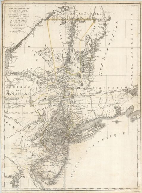
Subject: Colonial New England

Period: 1778 (dated)

Publication: Atlas Ameriquain Septentrionale

Color: Hand Color

Size:
20.5 x 28 inches
52.1 x 71.1 cm
Download High Resolution Image
(or just click on image to launch the Zoom viewer)

Please see lot 430 for additional map of New England.

A detailed, Revolutionary War map describes the region from Salem, to Buzzard's Bay south to the Delaware River and west to Lake Ontario, including New York, Connecticut, Rhode Island, New Hampshire, Massachusetts, and portions of Pennsylvania and Maryland. Based on Claude Joseph Sauthier's 1776 A Map of the Province of New-York, reduc'd from the large drawing of that Province, it was published by William Faden and taken from Razten's information of the region.

References: McCorkle #778.18.

Condition: C

A dark impression with remnants of the original outline color. There is an area of mildew centered on Staten Island. The centerfold is weak and has been reinforced, but it would benefit from further reinforcement. A few spots of foxing, close binder's trim in lower left corner, hinge remnants on verso.

Estimate: $1,000 - $1,200

Sold for: $600

Closed on 9/26/2007

Archived