Subject: United States - Eastern
Period: 1850 (circa)
Publication: Illustrated Atlas and Modern History of the World
Color: Hand Color
Size:
12.5 x 9.6 inches
31.8 x 24.4 cm
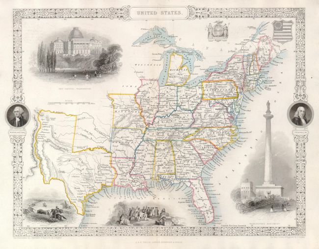
The map presents some interesting boundaries. The new state of Texas is shown at its largest extent, with the panhandle extending to the Arkansas River and including Santa Fe. Wisconsin and Iowa are shown with amorphous boundaries. This beautifully engraved map is surrounded by a decorative border with portraits of Washington and Franklin. Within the map are vignettes of a buffalo hunt, Penn's treaty with the Indians, Washington's Monument in Baltimore, Maryland, and two U.S. seals. Illustrations by J. Marchant and engraved by J. Rogers, the map drawn and engraved by J. Rapkin.
References:
Condition: A
A nice example with original outline color. The centerfold has been reinforced with a very fine Japanese tissue, and there is a short tear in the bottom margin, not affecting the map.