Subject: Colonial United States
Period: 1778 (dated)
Publication:
Color: Hand Color
Size:
28.5 x 20 inches
72.4 x 50.8 cm
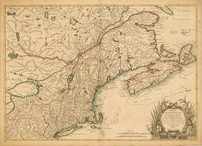
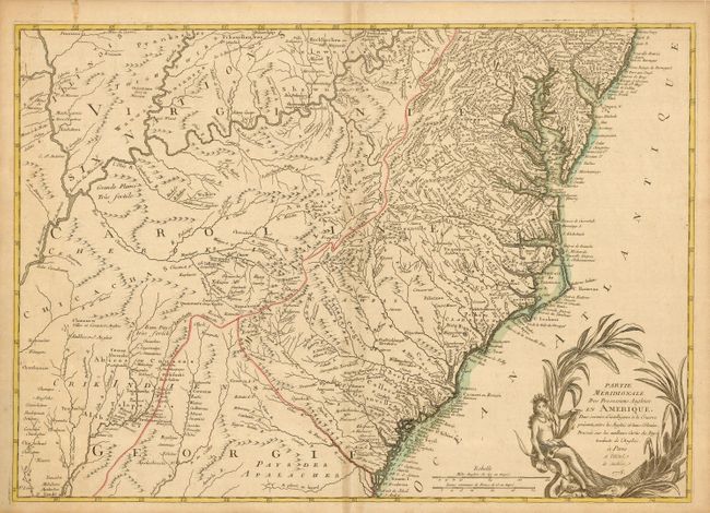
Extremely rare pair of Revolutionary War period maps are based on John Mitchell's monumental map of 1755, as noted in the cartouche …les meilleurs Carte du Pays traduite de l'Anglois, de Michel. These maps include some interesting differences in the colonial names. Present-day Maine is broken into Province de Sagahadoc in the northeast portion including Penobscot Bay and Province du Continent in the southern part encompassing Casco Bay down to York, and including Fort Western. The entire state of Massachusetts is named Masachusets Bay. Virginia, Carolina and Georgia extend to the Mississippi River, although a border is placed along the Appalachian Mountains. Together the maps cover the entire theater of war from the Gulf of St. Lawrence, south to St. Simons Sound in Georgia, and west to the Ohio Valley. Both maps stand alone with their own decorative cartouches; but if joined. would measure 40.5 x 28.5". The maps were separately published and are rarely seen on the market as a matched pair.
Ambrose Verrier and Francoise Perrier were apprentice engravers who succeeded their employer, Roch-Joseph Julien in his Paris map shop located at the Hotel de Soubise in 1777. Since the loss of the French colonies in America in 1763, French cartographers relied on English maps for new information on North America. Verrier and Perrier established a relationship with William Faden, publisher of the Mitchell map. Their investment in these maps reflects the increased demand in France for maps of North America. It is one of the first cartographic efforts published following the alliance formed between France and the American Revolutionists in February 1778.
References: Sellers & Van Ee, #161; McCorkle #778.2 (top sheet, attributed Brion de la Tour).
Condition: B+
A pair of sturdy sheets with a few minor spots and toning along the centerfold. Lovely impression and original outline color.