Subject: Canada
Period: 1856 (dated)
Publication: New Universal Atlas
Color:
Size:
15.8 x 12.5 inches
40.1 x 31.8 cm
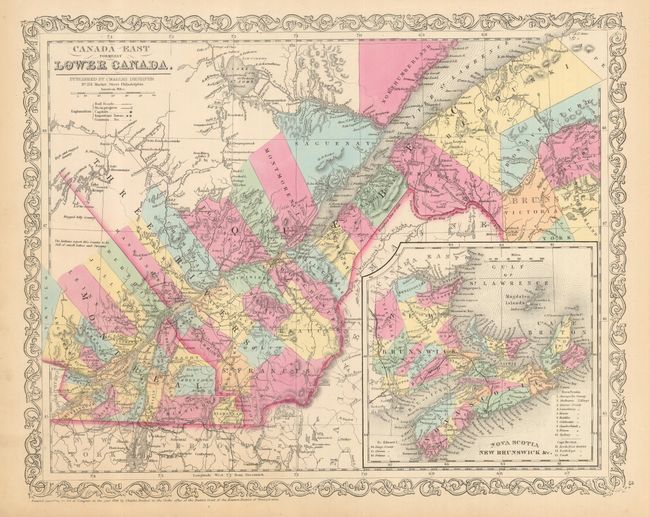
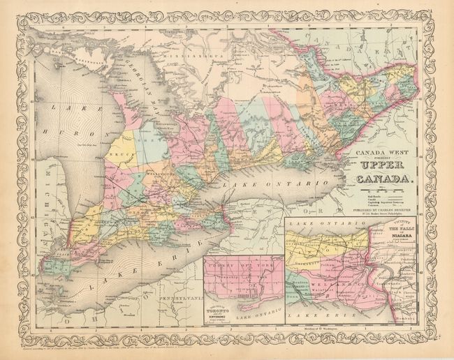
Matched pair of nicely engraved maps of Canada. These maps originated with Samuel Augustus Mitchell in his atlas. The first map is centered on Quebec and shows good detail along the St. Lawrence. Large inset of the Maritime Provinces is titled "Nova Scotia New Brunswick &c." The second map is centered on Toronto and shows all of Lake Erie and Lake Ontario. It extends east to beyond Cornwall on the St. Lawrence, and west to Detroit. There are insets of the City of Toronto and another of the vicinity of the Falls of Niagara. Both surrounded by Desilver's unique scroll-style border and carrying his imprint at No. 251 Market Street, Philadelphia. A nice pair in fine condition.
References:
Condition: A+
Lovely original color, good impression and full margins.